
Hawaii Travel Maps
A hawaii map is the first thing you need when planning an island trip. The four major visitor islands each have distinct geography, road systems, and coastlines that look nothing alike on paper.
Below you'll find free printable road maps, beach maps, driving time charts, and an interactive attractions map for Kauai, Oahu, Maui, and the Big Island.
Every map on this page is free to view, download, and print. We also offer a premium map + guidesheet bundle with higher-resolution versions and island-by-island travel summaries.
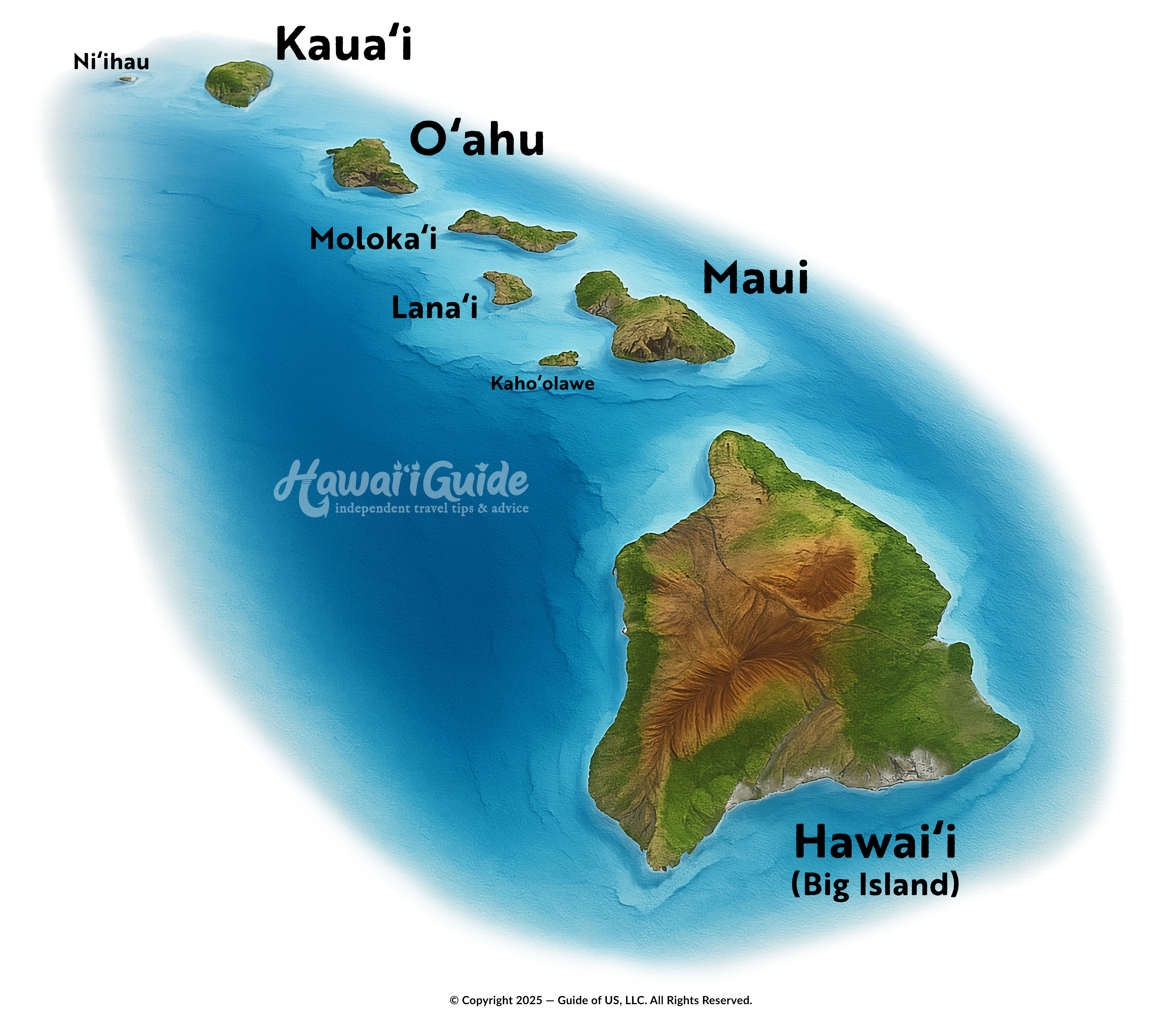
3D Hawaiian Islands
Mahalo (Thank you) for choosing HawaiiGuide.com for your travel needs!
- We are a small independent (non-taxpayer funded) publisher supported by visitors like you.
- If you find our free maps resourceful and valuable, please consider making a small tip/donation to help us continue creating free Hawaii travel materials.
- Every little bit helps support our small business. Mahalo for your support!
Free Hawaiian Islands Maps
Hawaii Statewide Maps
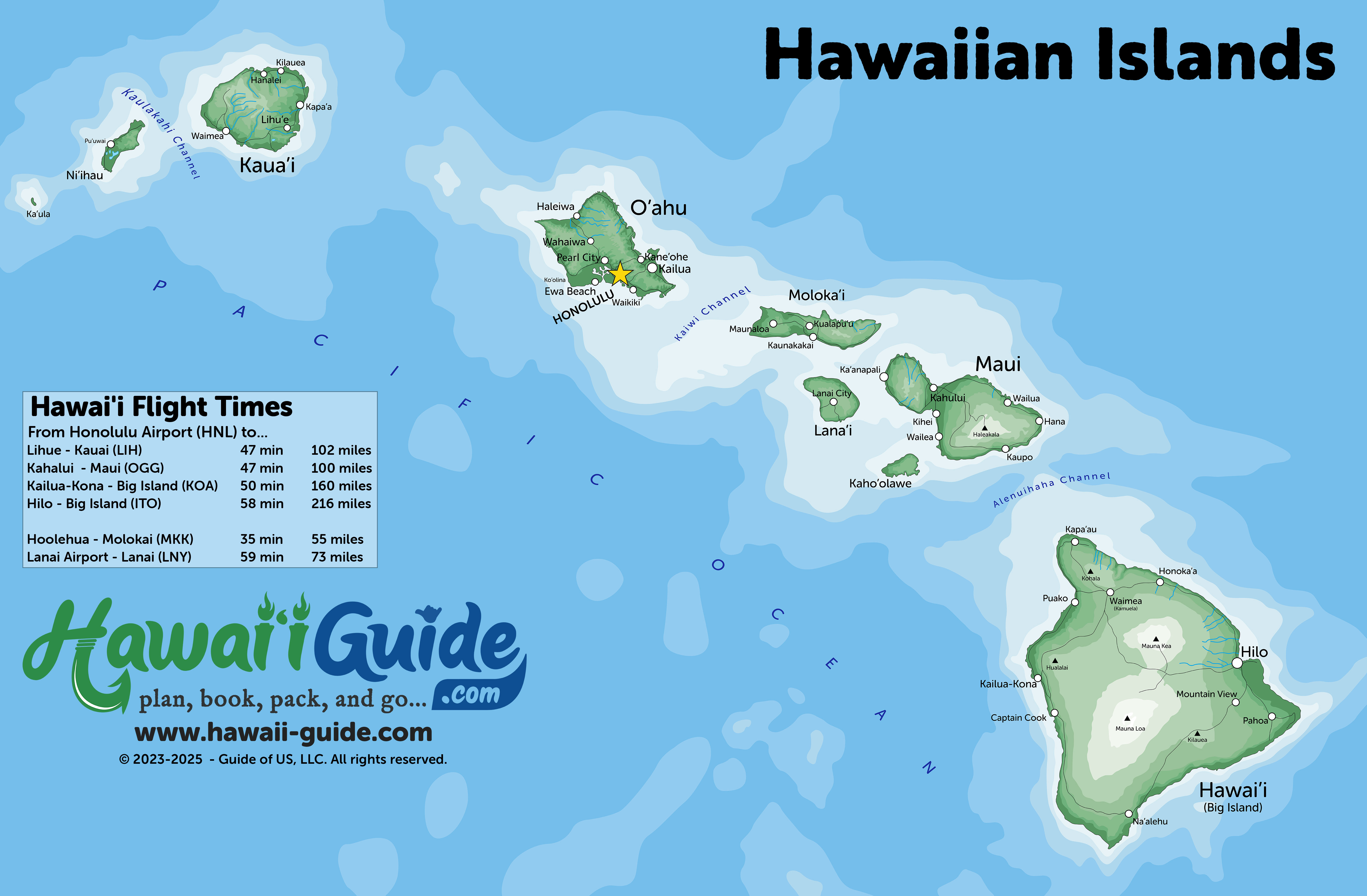
Island Maps
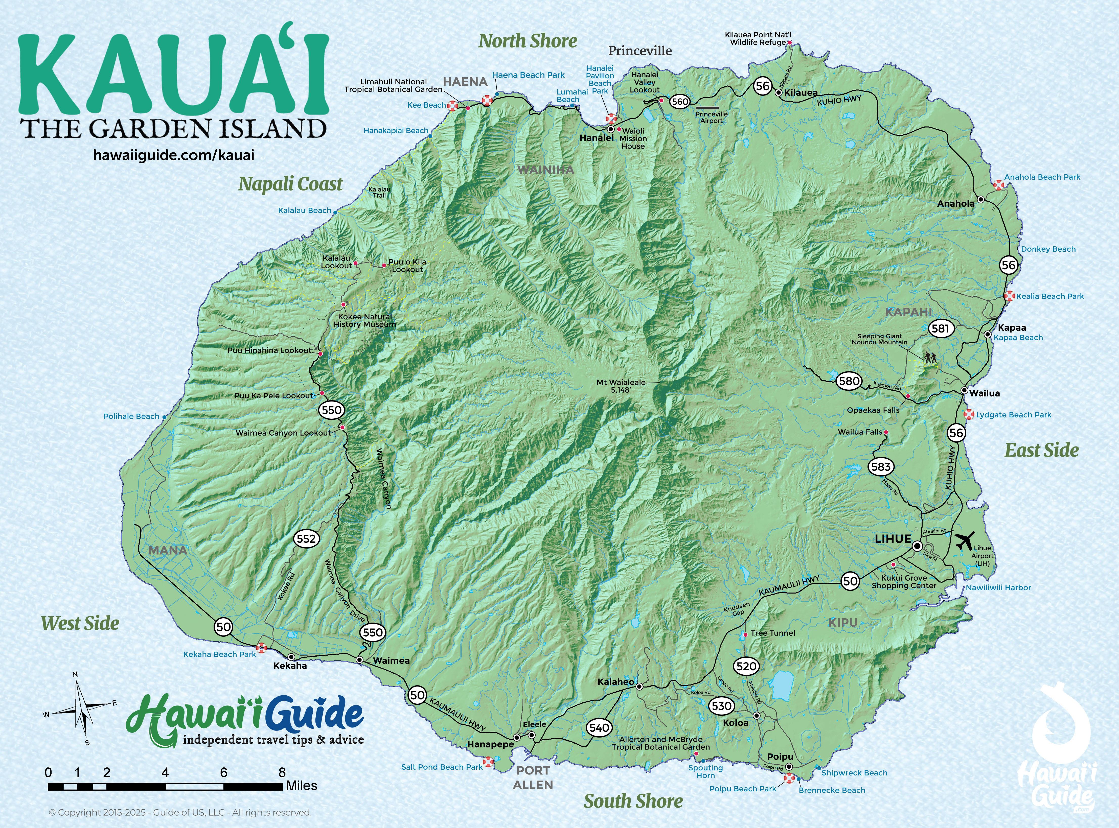
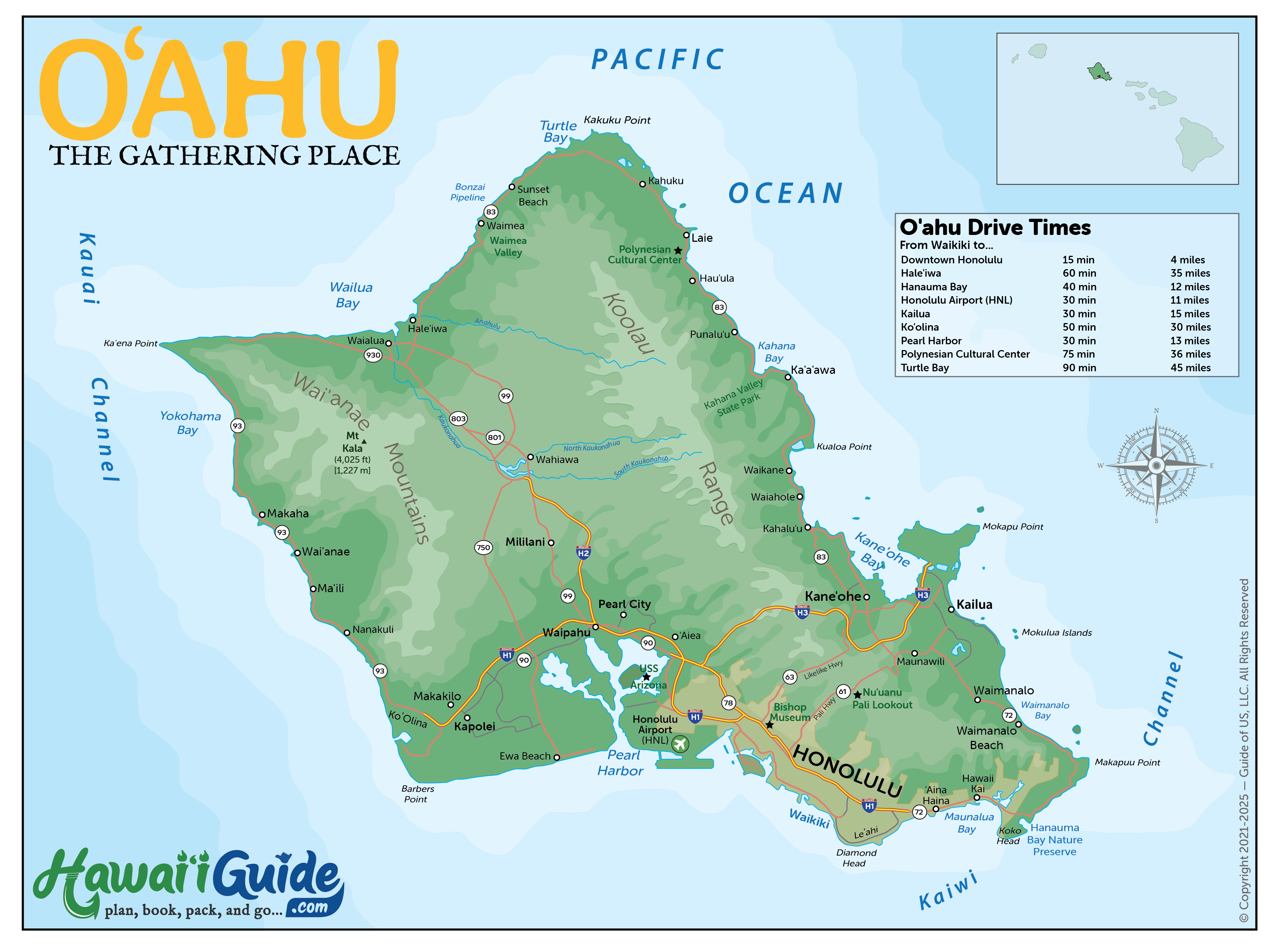
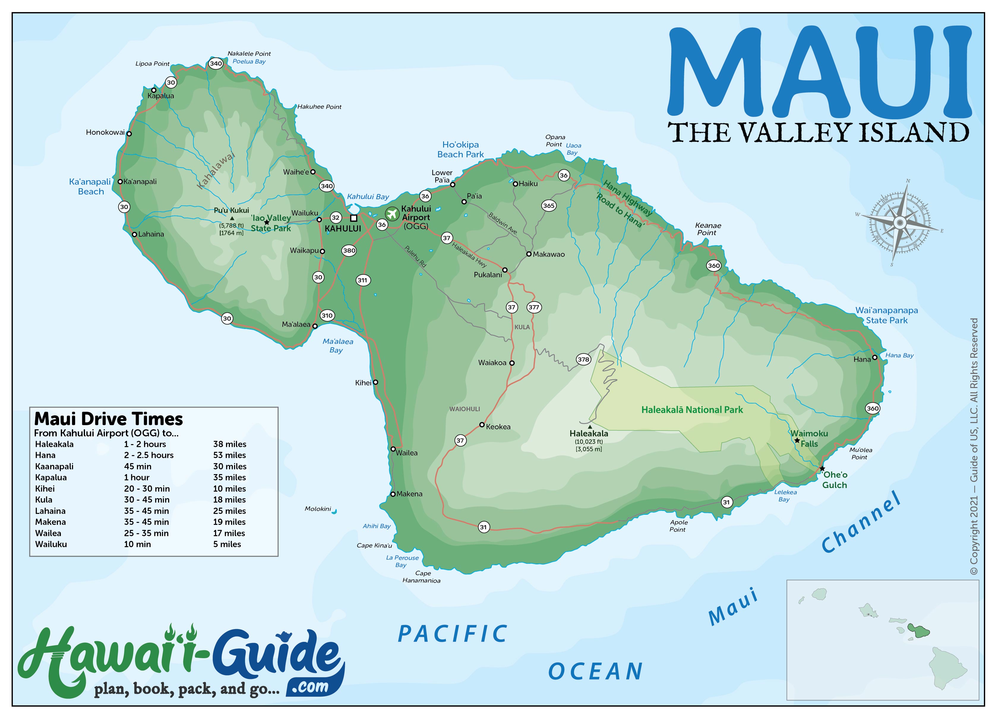
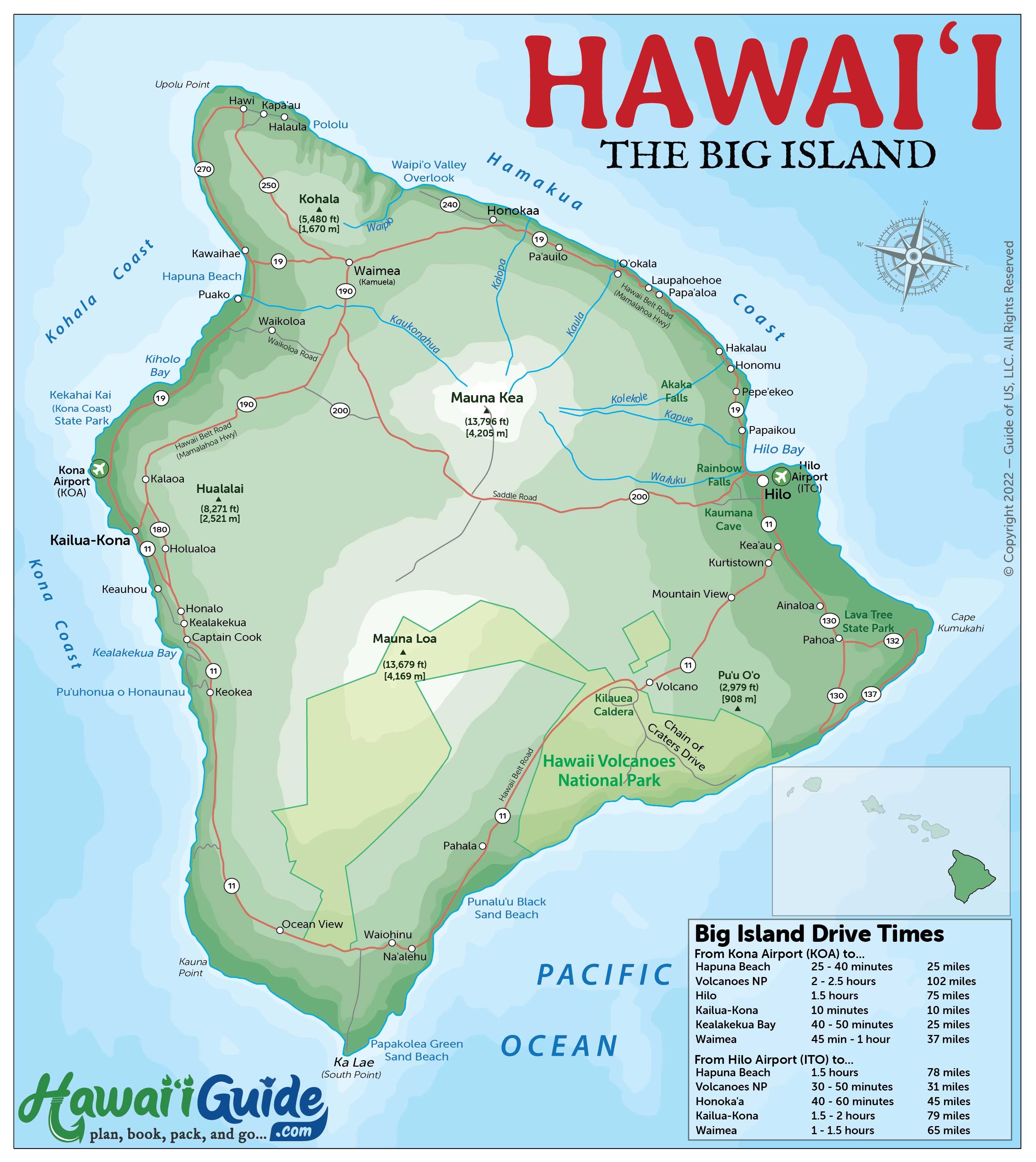
Each island map below shows major highways, towns, airports, and key landmarks. Click any map to view it full-size for printing. For more detailed maps with beaches, hiking trails, and driving times, visit each island's dedicated maps page.
Which Map Do You Need?
- Planning a trip: Start with the interactive map above to browse attractions, then download island-specific PDFs below
- Driving the Road to Hana: Road to Hana mile-by-mile map
- Finding beaches: See each island's beach map — Oahu · Maui · Big Island · Kauai
- Hiking trails: Kauai hiking maps
- Airport navigation: Oahu/Honolulu · Maui/Kahului · Big Island/Kona
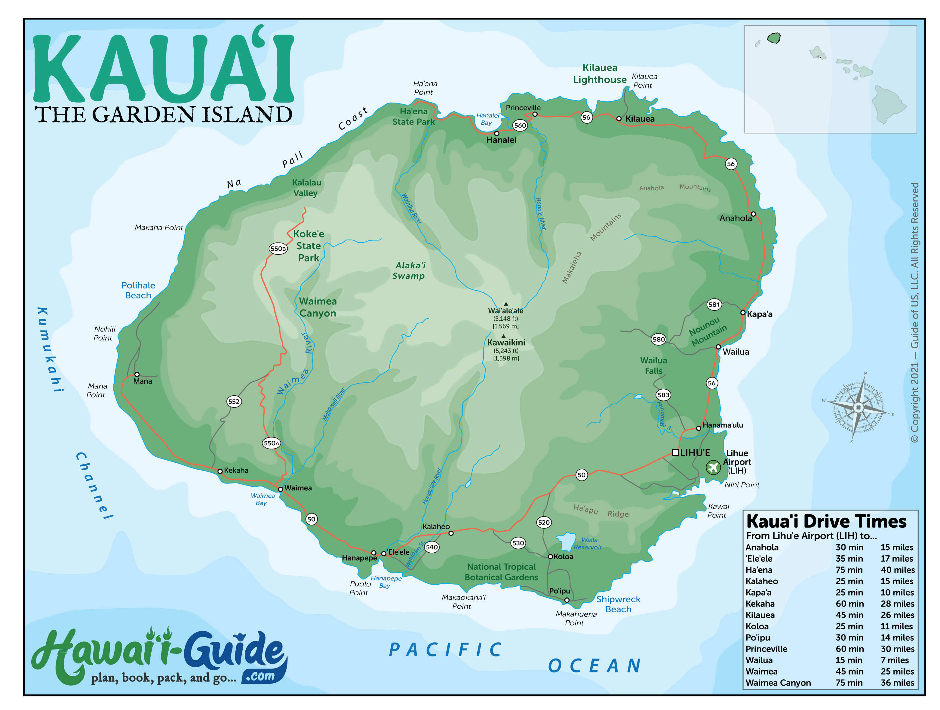
Individual Free Island Maps
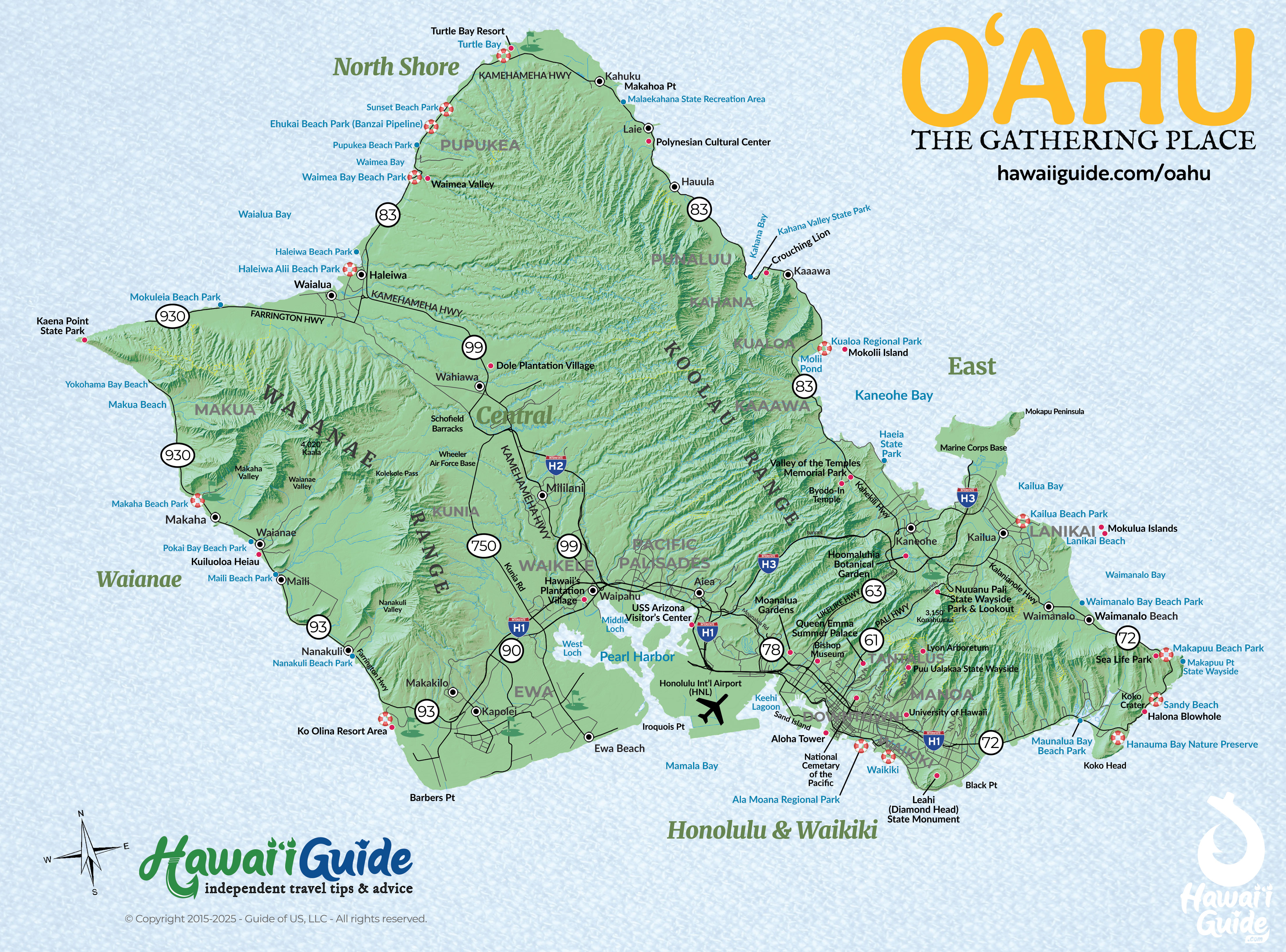
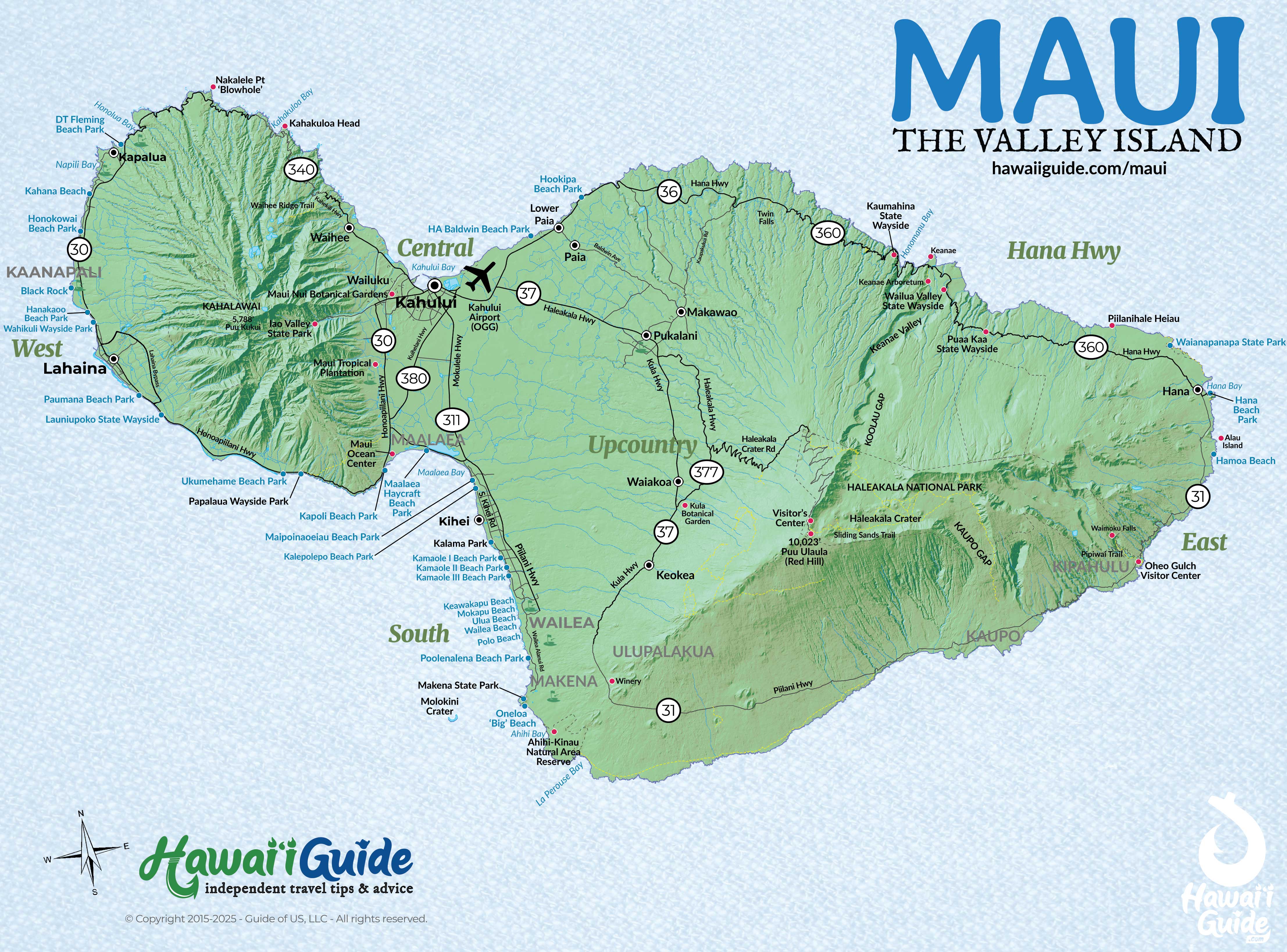
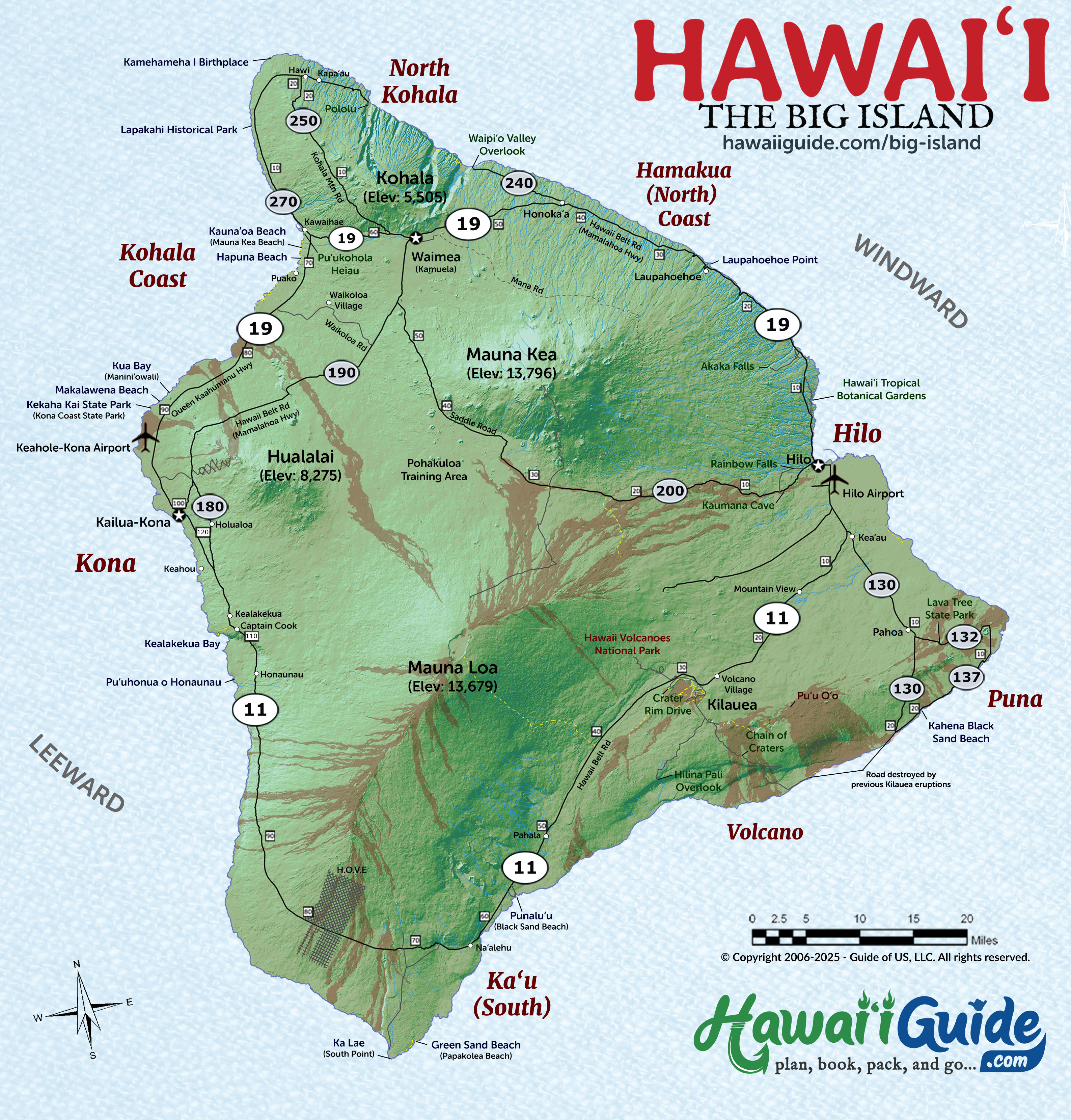
Island Road Maps
Hawaii Travel Maps: Your Complete Map Collection
Map of Hawaii
Hawaii Bathymetry & Elevation Map
(courtesy of sources listed)
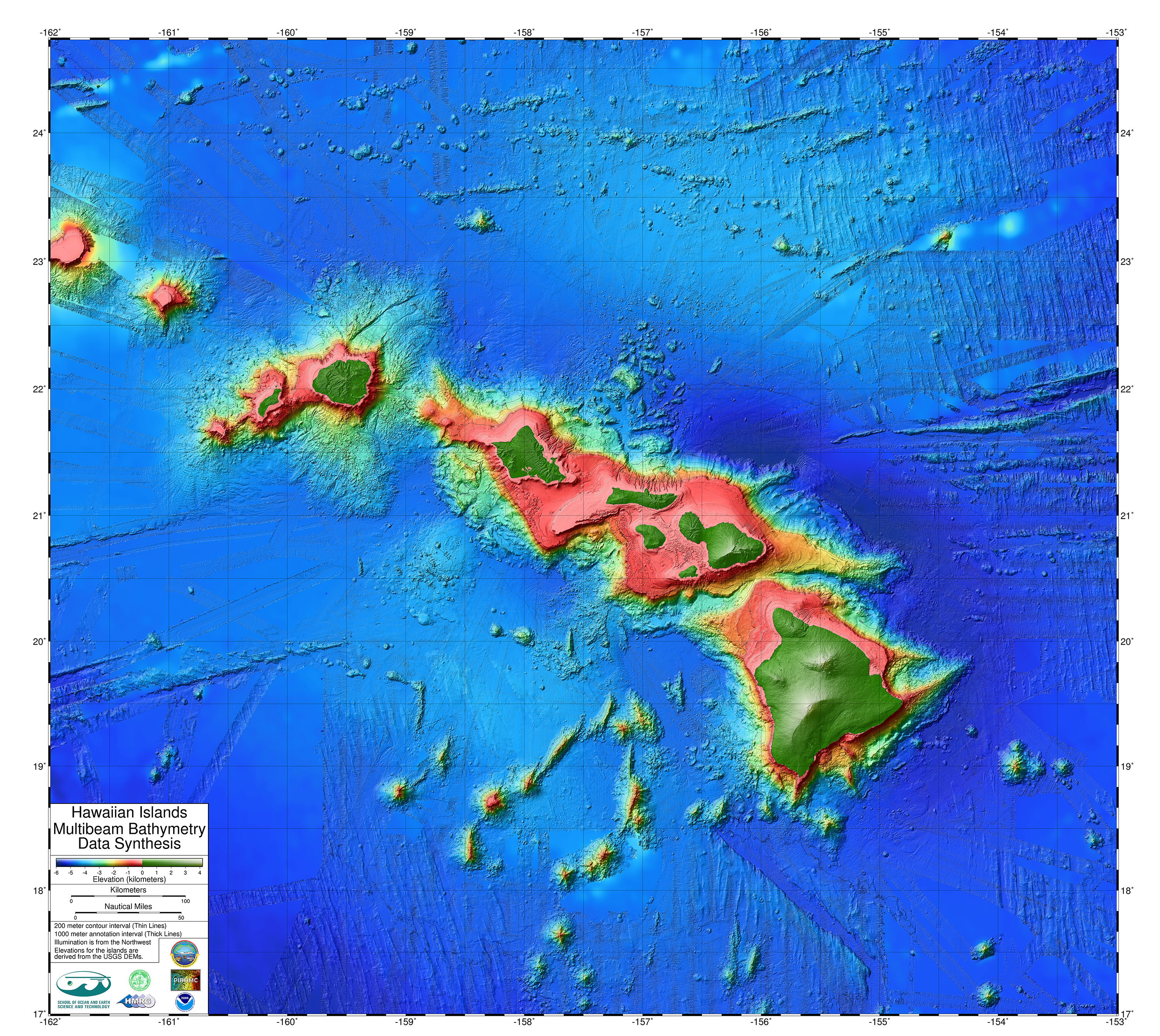
Hawaii Bathymetry & Elevation Map

2026 Hawaii Travel Map Packet + Summary Guidesheets
Driving + Beach Maps for Oahu, Maui, Kauai, and the Big Island
Updated with new high-resolution maps of Oahu, Kauai, Maui, and the Big Island. Includes most major attractions, all major routes, airports, and a chart with estimated driving times for each respective island.
- Our included Maui Map packet has a Maui Road Map, Maui Beaches Map + our detailed Road to Hana Map.
- Our included Kauai Map packet has a Kauai Road Map + Kauai Beaches Map.
- Our included Big Island Map packet has a Big Island Road Map + Big Island Beaches Map.
- Our included Oahu Map packet has an Oahu Road Map + Oahu Beaches Map.
For the best value, grab our Hawaii Maps + Guidsheet bundle. Our 2026 Hawaii Summary Guidesheets now additionally include the top must-see & do attractions, best times to visit, where to stay briefing, airport detail, a monthly weather summary, and where to find the most noteworthy local ono 'grindz' (best eats) on each respective Hawaiian Island.
There are now two options available for purchase below:
- Hawaii 2026 Maps Packet - $7.50
- Hawaii Maps Packet + 2026 Guidesheets - $11.00
-File is prepared as a print-ready PDF document
Other Hawaiian Map Resources
Discover Hawaii with Shaka Guide's Complete Hawaii Tour Collection

-- Click Image for More Information --
Explore Hawaii's stunning beauty and rich culture with Shaka Guide's Complete Hawaii Tour Collection. This comprehensive bundle offers a seamless travel experience across the Hawaiian Islands, featuring GPS-guided audio tours designed to enhance your journey. Whether driving through lush landscapes, hiking scenic trails, or soaking in the local history, our tours provide engaging narratives and insider tips to make your trip unforgettable.
