
Oahu is a beautiful and diverse island, with something for everyone to enjoy. From its picturesque beaches to its unique culture and attractions, Oahu is a paradise for most visitors. Here you'll find maps to help you explore the island.
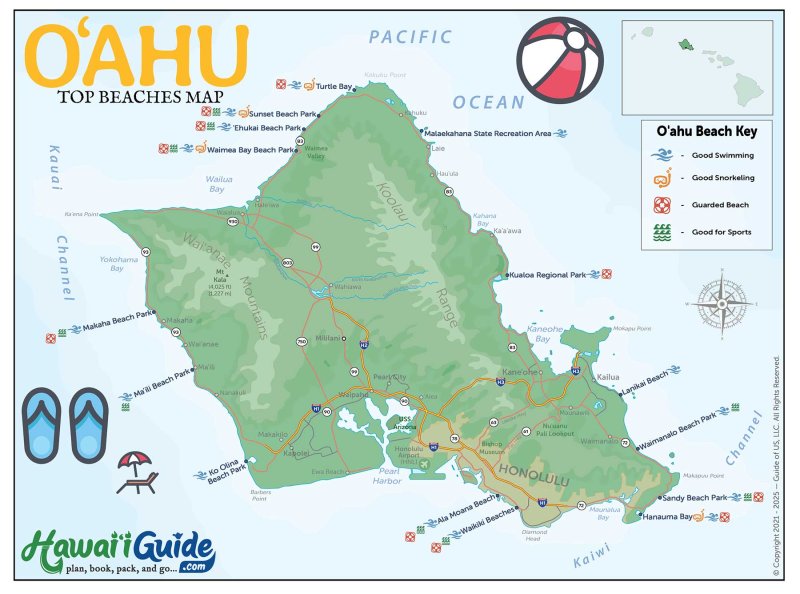
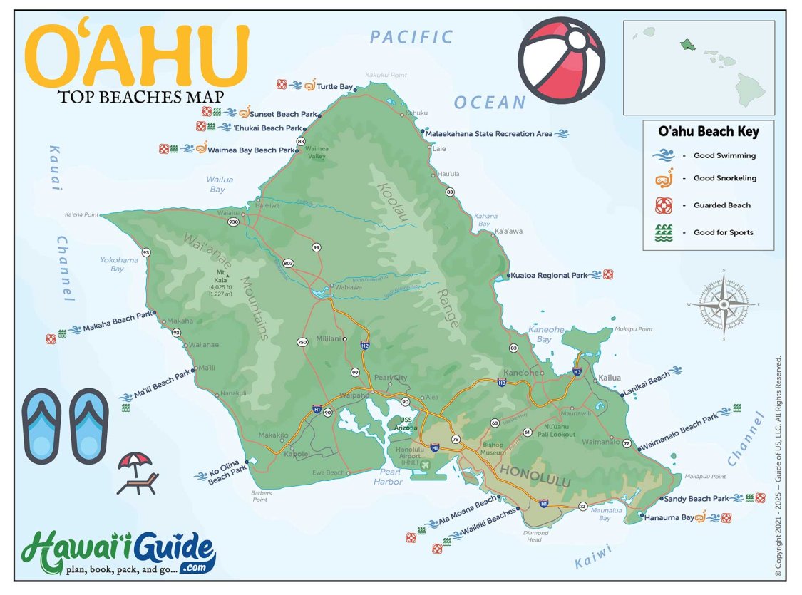
Our Oahu top beaches map is a great resource for planning a beach day, while our other maps will help you find the best attractions and experiences on the island. So start exploring, and let us help you plan an unforgettable Oahu adventure!
Below you'll find a few maps of Oahu Hawaii that we've put together, including our updated Oahu Travel Map Packet that includes an new high-resolution map!
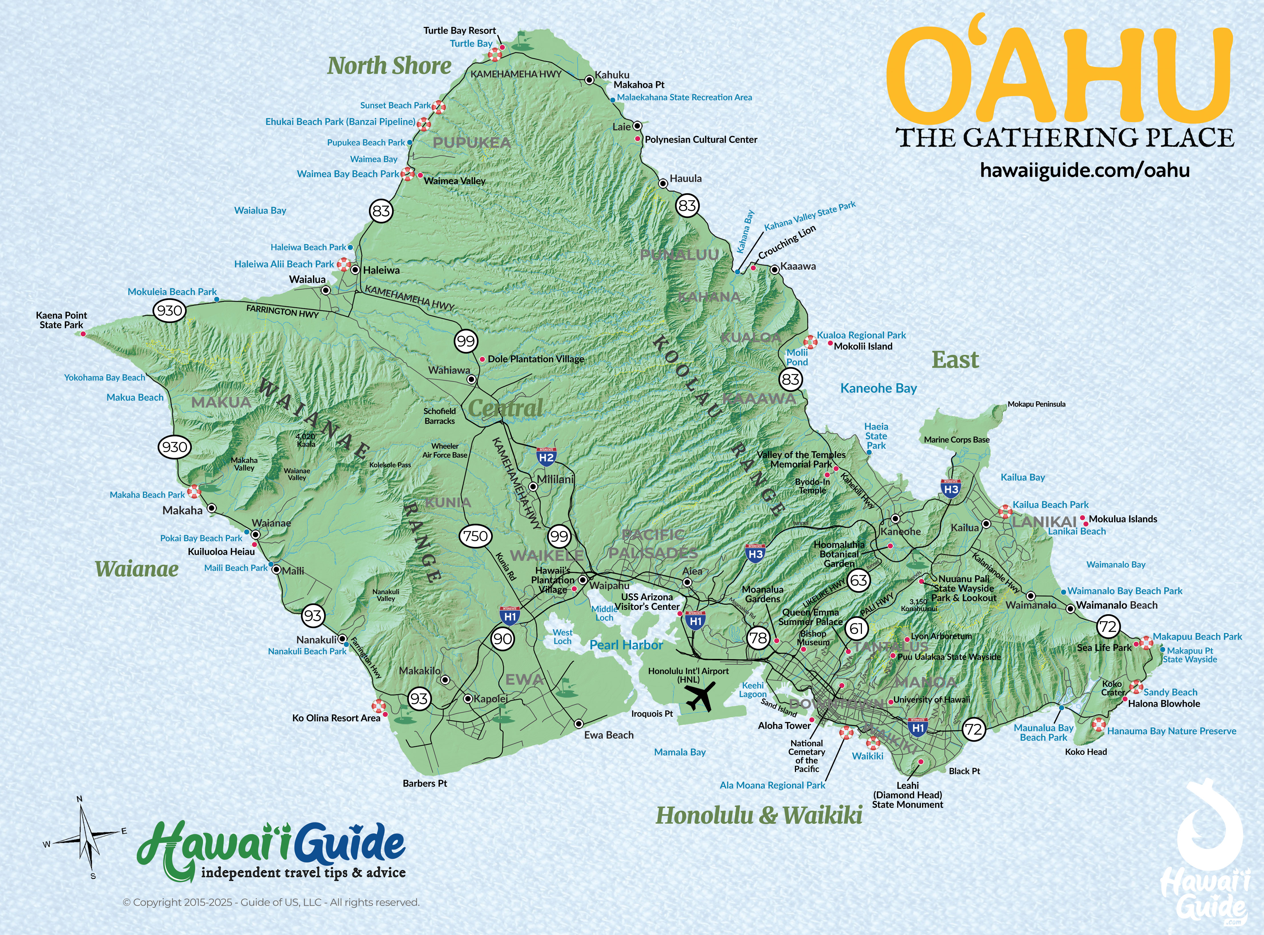
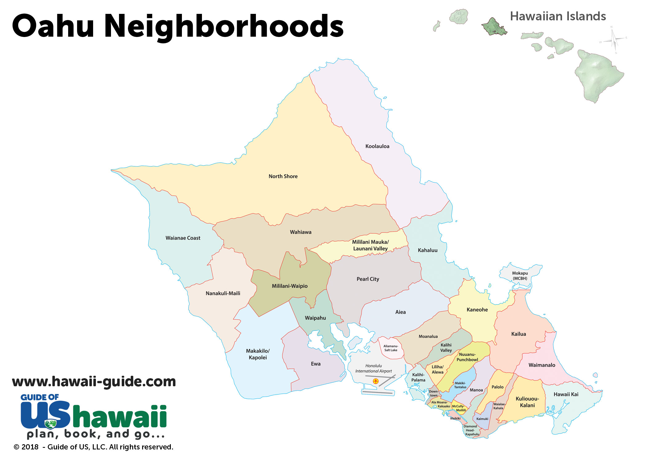
Oahu Regions at a Glance
Oahu packs more variety into 597 square miles than any other Hawaiian island. Six distinct regions, each with a completely different character.
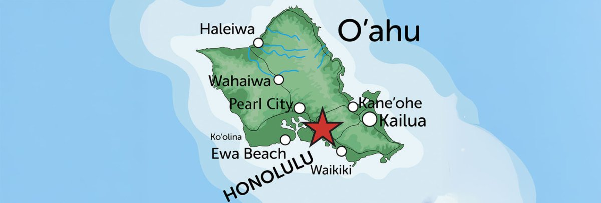
Waikiki & Honolulu (South Shore)
The urban heart of Hawaii. Waikiki's 2-mile beach strip has the densest concentration of hotels, restaurants, and shops in the state. Diamond Head sits at the eastern end. Downtown Honolulu — 10 minutes west — has Chinatown, Iolani Palace, and the state capitol. This is where most first-time visitors stay, and for good reason: everything is walkable or a short bus ride away.
North Shore
The surf capital of the world. In winter (November-February), waves at Pipeline, Sunset Beach, and Waimea Bay reach 30-60 feet. In summer, the same beaches are flat enough for families. Haleiwa town has shrimp trucks, shave ice, and surf shops. The North Shore is about 45-60 minutes from Waikiki via H-2 — far enough to feel like a different island.
Windward Coast (East Side)
The green, wet, dramatic side of Oahu. The Ko'olau mountain range drops straight into the ocean. Kailua and Lanikai have two of the best beaches in Hawaii — white sand, turquoise water, consistently calm. Kaneohe Bay has a sandbar you can wade to at low tide. The Pali Highway connects Honolulu to the Windward side through the Ko'olau mountains in about 25 minutes.
West Side (Leeward Coast)
The dry, local, less-touristy side. Ko Olina has Disney's Aulani resort and four man-made lagoons. Kaena Point — Oahu's westernmost tip — is a rugged coastal hike to a protected albatross nesting area. The Waianae coast has some of the island's emptiest beaches but fewer visitor services. Less infrastructure, more authentic.
Central Oahu
The agricultural plateau between the Waianae and Ko'olau ranges. Home to Dole Plantation (pineapple garden and maze), Pearl Harbor and the USS Arizona Memorial, and the H-2 freeway connecting Honolulu to the North Shore. Not where you stay, but what you drive through to get everywhere else.
East Honolulu & Hawaii Kai
The stretch from Diamond Head east to Makapuu Point. Hanauma Bay (volcanic crater snorkeling), Koko Head (1,048-step staircase hike), Halona Blowhole, and Makapuu Lighthouse Trail are all along this coast. Highway 72 (Kalanianaole) is one of Oahu's most scenic drives, hugging the cliffs between Hawaii Kai and Waimanalo.
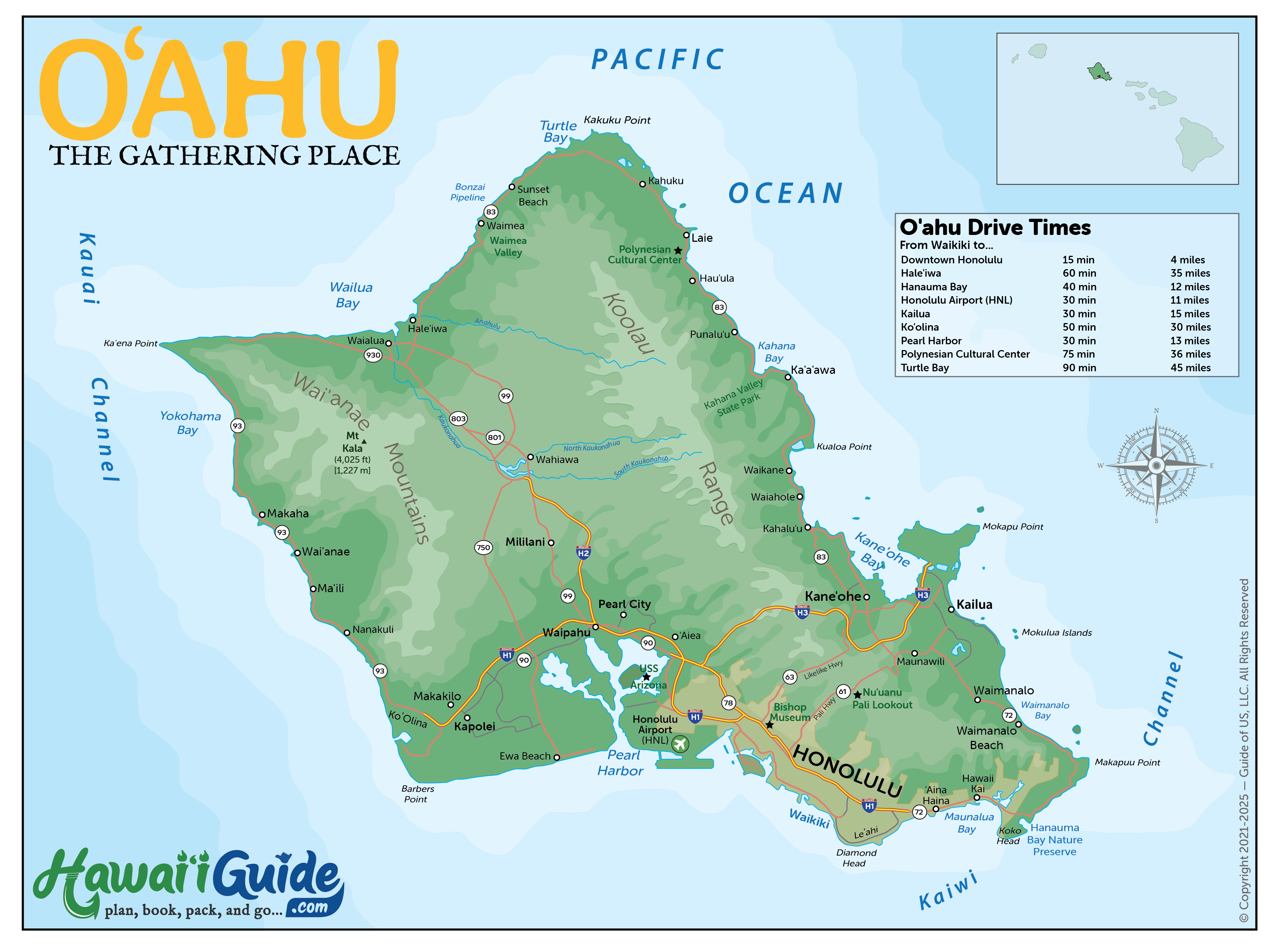
Oahu Driving Times Between Destinations
Oahu is compact, but traffic can double your drive time. These estimates assume normal (non-rush-hour) conditions. Add 20-40 minutes during morning (6:30-8:30 AM) and evening (3:30-6:00 PM) rush on H-1 and H-2.
| From | To | Distance | Drive Time |
|---|---|---|---|
| Waikiki | North Shore (Haleiwa) | 34 mi | 45-60 min |
| Waikiki | Kailua / Windward | 14 mi | 25-30 min |
| Waikiki | Pearl Harbor | 11 mi | 20-30 min |
| Waikiki | Hanauma Bay | 12 mi | 25 min |
| Waikiki | Ko Olina / West Side | 27 mi | 35-45 min |
| HNL Airport | Waikiki | 10 mi | 20-30 min |
| North Shore | Kailua / Windward | 28 mi | 40-50 min |
| Kailua | Kaneohe | 7 mi | 15 min |
Oahu traffic is notorious. H-1 westbound in the morning and eastbound in the evening can add 30-60 minutes to any trip. Plan North Shore and Windward excursions to avoid rush hour — leave Waikiki by 8 AM or after 9:30 AM, return before 3 PM or after 6 PM.
Updated Oahu Travel Map Packet + Guidesheets
Updated with a new high-resolution map of Oahu. Includes most major attractions, all major routes, airports, and a chart with Oahu & Honolulu's estimated driving times.
PDF packet now additionally includes an Oahu Beaches Map.
Our 2026 Oahu Summary Guidesheet includes the top must-see & do attractions, best times to visit, where to stay briefing, airport detail, a monthly weather summary, and where to find the most noteworthy local ono 'grindz' (best eats) on Oahu.
-File is formatted as a print-ready PDF document
Printable Free Oahu Hawaii Maps
Click any map to view full size or download for offline use.
