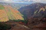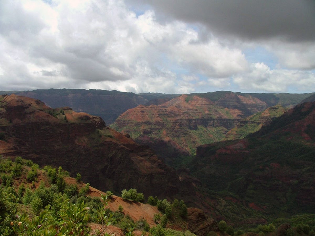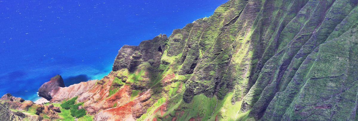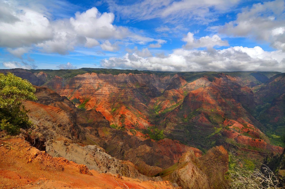
Waimea Canyon — The Grand Canyon of the Pacific
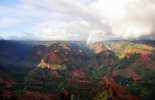
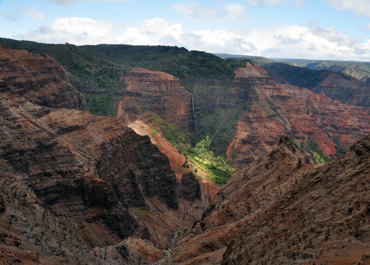
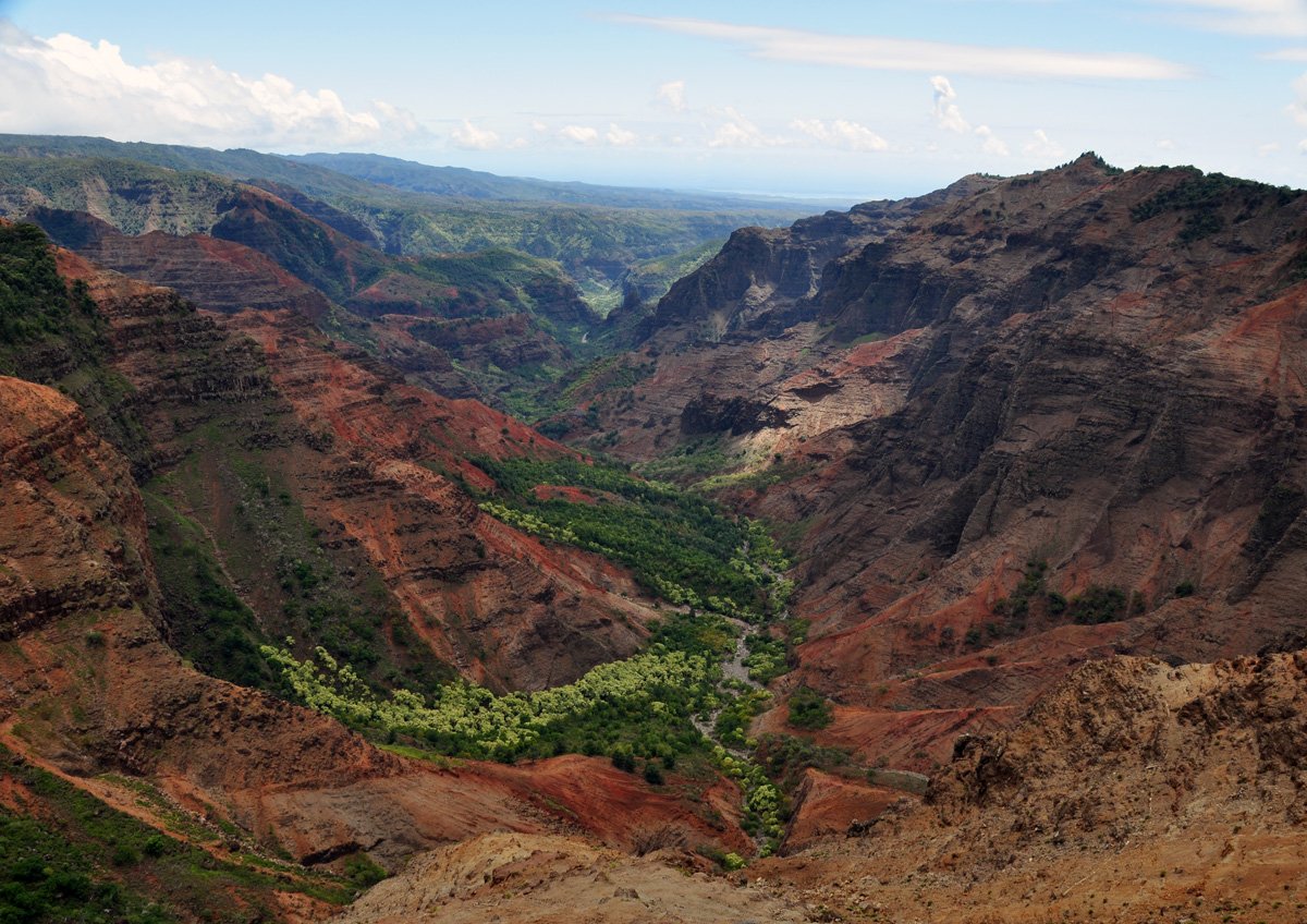
Dubbed "The Grand Canyon of the Pacific" by Mark Twain, Waimea Canyon is the largest canyon in the Pacific and truly a dramatic sight to behold at ten miles long, one mile wide, and more than 3,500 ft. deep.
Waimea Canyon — Quick Facts
- Entry: $5/person + $10/vehicle (Kokeʻe & Waimea Canyon State Park)
- Scale: 10 miles long, 1 mile wide, 3,600+ feet deep — largest canyon in the Pacific
- Getting there: From Waimea town, take Hwy 550 uphill — about 1 hour from Lihue Airport
- Best viewpoints: Waimea Canyon Lookout (mile 10) and Puʻu Hinahina Lookout (mile 13.5). Continue to Kalalau Lookout (mile 18) for Na Pali views.
- Go in the morning: Afternoon fog and clouds often obscure the canyon. Best views before noon.
- Temperature: Canyon rim sits at 3,000–4,000 ft — bring a light jacket even on warm days
Carved thousands of years ago by rivers and floods that flowed from Mount Waialeale's summit, the canyon is home to the Waimea River. The river was named for the red hue of the water, as Waimea means 'red waters.' The red tint is caused by several natural processes that break down the ancient rock inside the gorge. Like the Grand Canyon in Arizona, through the processes of weathering (precipitation), mass wasting (gravitational breakdown), and erosion (by the river), the walls of Waimea Canyon are literally being rusted, broken down, and carried out to sea over time. From space, you can even see the tinted runoff making its way into the ocean.
*As of April 19, 2021, all visitors will need to pay a $5 entrance fee to visit the Kokee & Waimea State Park in addition to any parking fees.
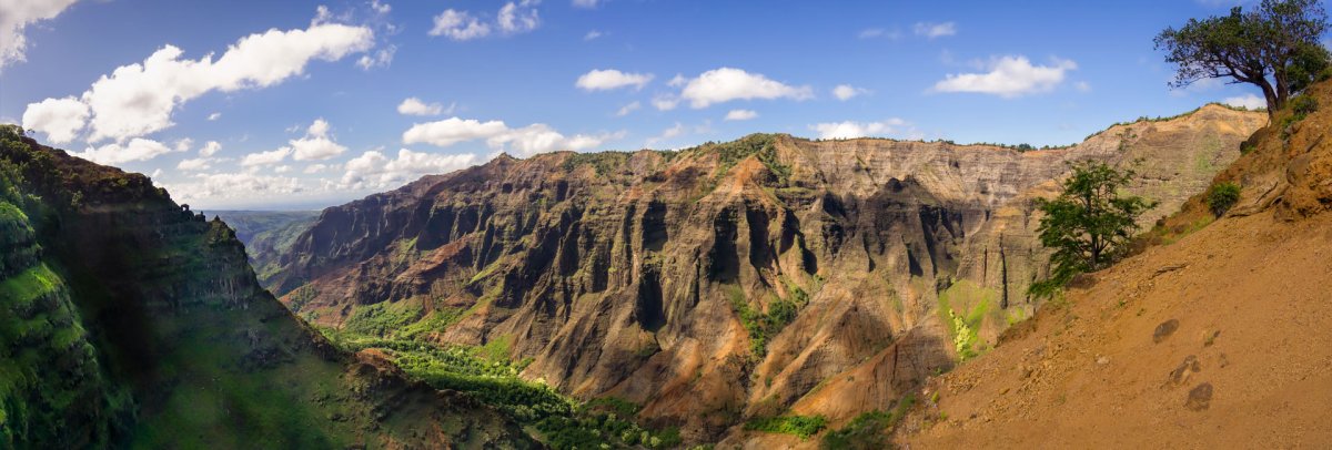
Waimea Canyon Lookouts
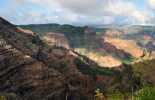
There are three "official" lookout spots from which you can view the Waimea Canyon: the official Waimea Canyon lookout (just past Mile Marker 10 on Hwy. 550); the Puu Ka Pele lookout (a smaller lookout near mile marker 13 on Hwy. 550); and Puu Hinahina Lookout (between mile markers 13-14 on Hwy. 550), which we believe to be the best of the three lookouts.
A word of advice: before you begin your journey up Hwy. 550 be sure to check your gas gauge. The round trip is about 36 miles with an elevation change of 4,000 feet. Take Hwy. 50 west from Hanapepe toward Waimea. Waimea Canyon Drive is on the right just past mile marker 23. The road travels through the canyon area and ends at Puu o Kila Lookout. Makaha Ridge Road runs off Waimea Canyon Road just before mile marker 14 and travels to more scenic lookouts. Numerous lookouts and trails lead off of these two roads.
Whether you explore Waimea Canyon by yourself or with a guide, you simply must see its spectacular beauty in person!
Best Hikes in Waimea Canyon
The canyon isn’t just for looking at from above. Several trails take you along the rim, to waterfalls, or down into the canyon itself. Here are the best options sorted by difficulty.
Iliau Nature Loop (0.3 miles, Easy)
A flat, short loop right off Highway 550 near the Waimea Canyon Trail trailhead. Good for anyone who wants a quick stretch and canyon views without committing to a real hike. You’ll see the native iliau plant (found only on Kauai) and get views into the upper canyon. Takes about 15-20 minutes.
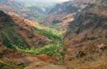
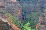
Canyon Trail to Waipoʻo Falls (3 miles roundtrip, Moderate)
The most popular hike in Waimea Canyon. Starts at the Puʻu Hinahina Lookout area and descends along the canyon rim to a viewpoint overlooking 800-foot Waipoʻo Falls. The trail is well-maintained but has some steep sections and exposed cliff edges. Allow 2-3 hours round trip. Bring water — there’s no shade for long stretches.
Kukui Trail (5 miles roundtrip, Difficult)
The only maintained trail that goes DOWN into Waimea Canyon to the canyon floor and Waimea River. Drops 2,000 feet in 2.5 miles — which means gaining 2,000 feet on the way back up. The descent takes about 45 minutes; the climb back takes 2+ hours. Stunning views but punishing on the knees. Experienced hikers only.
Cliff Trail & Black Pipe Trail (0.2 miles, Easy)
Short connector trail near the Canyon Lookout that gives you a different angle on the canyon than the main overlook. Great for photographers looking for a less-crowded vantage point. Often missed by visitors who stop only at the main lookout.
For trail maps and current conditions, check the Kauai hiking maps page or the trail status page.
Waimea Canyon Scenic Drive: Mile by Mile
Highway 550 (Kokee Road) climbs from sea level in Waimea town to over 4,000 feet at Kokee State Park. The entire drive is about 18 miles and takes 30-40 minutes without stops — but you’ll want to stop often.
Key stops along the drive:
- Mile 0 — Waimea Town: Fill up on gas and grab breakfast. Last services before the canyon.
- Mile 6 — Waimea Canyon Entrance: $5/person entry, $10/vehicle parking. Pay here or at the Kokee booth.
- Mile 10 — Waimea Canyon Lookout: The main viewpoint. Expansive views into the 3,600-foot-deep canyon. Restrooms and parking available. This is where most tour buses stop.
- Mile 12 — Puʻu Ka Pele Lookout: Less crowded than the main lookout with equally good views from a different angle. Worth the short walk from the parking area.
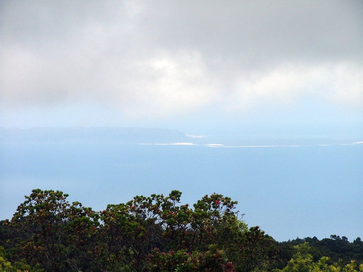
- Mile 13 — Puʻu Hinahina Lookout: Views of both the canyon AND the island of Niʻihau on clear days. Two-level viewing platform. Trailhead for the Canyon Trail to Waipoʻo Falls is nearby.
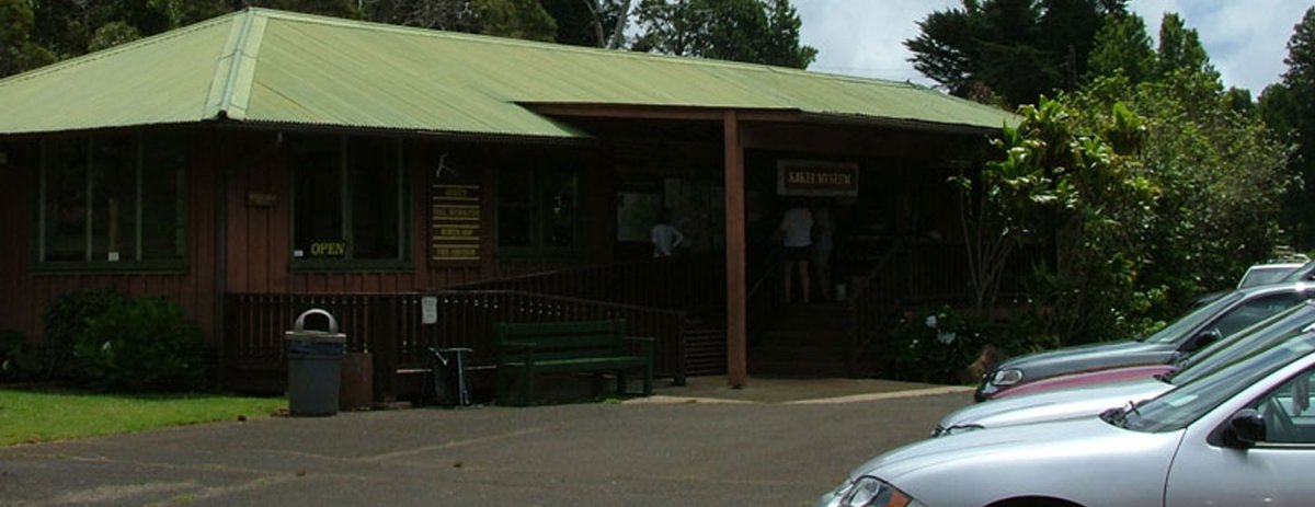
- Mile 15 — Kokee State Park: Picnic areas, the Kokee Natural History Museum (small but worth 20 minutes), and access to hiking trails in the Alakaʻi Swamp.
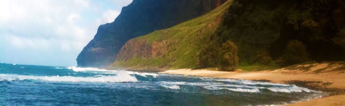
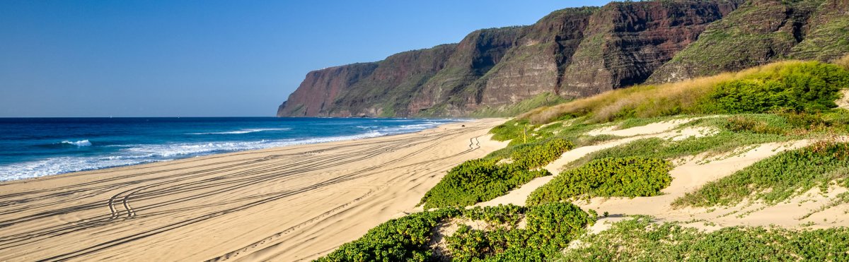
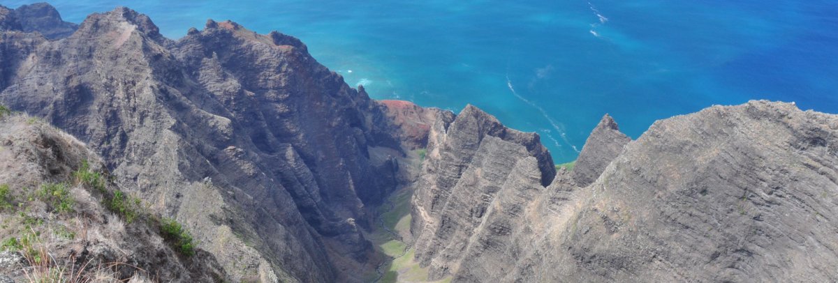
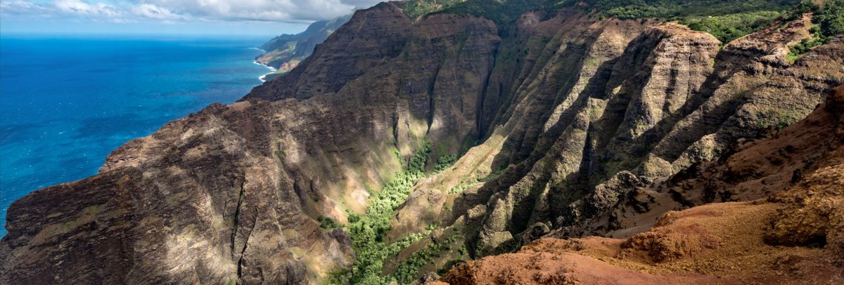
- Mile 18 — Kalalau Lookout: The end of the road. Views directly down into Na Pali Coast’s Kalalau Valley — one of the most photographed viewpoints in Hawaii. More about Kalalau Lookout.
- Mile 18.2 — Puʻu o Kila Lookout: Just past Kalalau, this is the true end of the road. Trailhead for the Pihea Trail into the Alakaʻi Swamp. Often fogged in by afternoon.
Driving tip: The road has guardrails in most places but is narrow with blind curves. Take it slow, use pullouts to let faster traffic pass, and watch for wild chickens and Nene geese (Hawaii’s state bird) crossing the road. See our Kauai maps page for driving times between destinations.
Best Time to Visit Waimea Canyon
Time of day: Arrive before 10 AM. Clouds roll into the canyon from the east side by late morning and can completely obscure the views by afternoon. If you’re driving from Poipu or Lihue, leave by 7:30 AM.
Season: The dry months (May through September) offer the best visibility and driest trail conditions. Winter (October through March) brings more rain to the upper elevations, and the Kokee area can be genuinely cold — temperatures drop into the 40s and 50s at 4,000 feet. Bring a jacket regardless of season.
Combination tip: Most visitors pair Waimea Canyon with Kokee State Park and the Kalalau Lookout in a single half-day trip. Start at the canyon, work your way up, and turn around at the Kalalau Lookout. Budget 3-4 hours for the drive and stops, add 2-3 hours if you hike.
Compare Kauai rental car rates — you’ll need a car to reach Waimea Canyon. No public transit serves the canyon road.

Waimea Canyon Map
Featured Waimea Canyon Tours
Our featured listings are some of the best Waimea Canyon Tours you'll find anywhere- from full-day hikes, family-friendly sightseeing tours, and spectacular helicopter tours that'll have you soaring right into this geologic marvel. These tours stand out for their exceptional guides, unique experiences, and their focus on highlighting what makes Waimea Canyon truly shine. Book your adventure today!
Hiking Gear
Make a great adventure even better by being prepared for anything you encounter along the trail. From great hiking boots, adventure cameras, Hawaii guidebooks, and more, we have a wide variety of hiking gear and travel supplies you'll need. Browse our selections, pick up what you need, and be safe, comfy, and well-outfitted with Hawaii Guide. Mahalo!