09-16-2022
Cliff and Canyon Trail
Waimea Hiking
Aloha! This article may link to trusted Hawaii resources at no extra cost to you. Mahalo for your support!
Waimea Canyon Hiking Trails
Koke'e and Waimea State Park
Hiking on Kauai is a great family-friendly activity; provided you pick the right trails. Thankfully, these three ridge-top trails not only fit the bill for family fun, they also have spectacular views of Waimea Canyon. Let's explore them a bit here.
We'll begin by saying that some hikers only go as far as Waipoo Falls along the Canyon Trail; others only take the short walk to the end of the Cliff Trail. Heading north on Hwy. 550 to just beyond the mile marker 14 (there is a 'Kokee State Park' entrance sign), you'll see Halemanu road splitting off the paved road to the right. The best place to park is on the makai (left) side of Hwy. 550, directly opposite Halemanu Road.
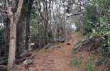
The hike down Halemanu Road to the beginning of the trail(s) is 3/4th of a mile one-way, with a right-hand turn when you reach the top of a hill at the 0.6 mile point. The trails will begin near a small parking lot at the end of the road. As you proceed down the trail, you'll soon come to a junction (with signs), where the Cliff Trail will split off to the right.
Starting from the main highway, the total distance for this hike is roughly 1.8 miles round trip; roughly an hour total for the hike and back.
At the same junction noted above, the Canyon Trail forks downhill to the left and it is slightly less than a mile (one-way) to the 'overlook' above Waipoo Falls. When starting from the main highway, the Canyon Trail is approximately four miles round trip and will take about 2-3 hours depending on hiking pace.
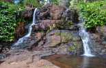
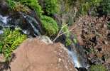
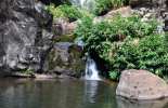
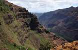
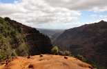
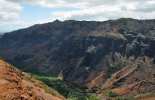
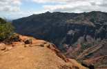
The views of the canyon on the approach to Waipoo Falls are wonderful, but please note that you CANNOT see the falls since you are actually above them (most folks do not realize then when they start the hike). There is a small pool surrounded by yellow ginger upstream from the main (hidden) falls. The trail includes a climb of several hundred feet in elevation and steep dropoffs along the canyon rim.
Waimea Canyon Lookouts
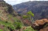
The “Grand Canyon of the Pacific” is a truly breathtaking sight at ten miles long, one mile wide, and more than 3,500 ft. deep. Make sure you take it all in from these official lookouts… we know you’ll love the view!
If you want a nicer hike than going down Halemanu road, as well as more parking, go to the Puu Hinahina lookout 1/4 mile back down the road (around MM 13.5). If you go to the back of the parking lot you'll find a trail that heads to the left. This (spur) trail actually joins up with the Cliff/Canyon trailhead right where the 4x4 cars park. Since it begins at a higher elevation and includes a dip into a side ravine it's more strenuous than the dirt road hike, but it's a lot more scenic; you actually cross one end of the Waimea Canyon. The trail is about 1/3-1/2 mi. long.
Don't forget to check our Kokee State Park Hiking page for information on all the incredible trails inside the park. On that page we've also posted a map of the entire area (Kokee and Waimea State Parks) for you to download and print out at home. The Kokee Lodge and Museum will also have maps available, but we'd definitely advise you to review the map and become familiar with the area before arriving. The crisscrossing of trails and 4x4 roads can be confusing at first, but once you select your routes, it's not too bad.
We loved this hike and welcome any questions you may have about the trails. Feel free to Contact Us.
Grab Your Free Travel Guides!
Kauai Intro Visitor Guide
+ Our Summary Guidesheet!
Includes the top must-see & do attractions, best times to visit, a monthly weather & visitor summary, and our tips on how to save when booking your car rental, tours, and activities. Plus, grab our free Kauai Summary Guidesheets. Check out our Updated Kauai Visitor Guides.
Featured Waimea Canyon Tours
We are proud to offer some of the best Waimea Canyon Tours you’ll find anywhere. Each is led by an expert guide and consistently receives rave reviews from happy customers. Whether you’re exploring with the kids or are looking for some challenging adventures, we have the tour for you. Remember to book as far in advance as possible to ensure tour availability, as they can fill up fast.
Hiking Gear
There’s nothing like hiking the magnificent Waimea Canyon, but doing so unprepared can make your adventure anything but fun. Pick up everything you’ll need to stay safe, comfortable, and well-equipped on your excursion- before you jet off to the islands.
Geolocation Data
Geographic Coordinates
Latitude: 22.11308949
Longitude: -159.6652714
Hawaii Safety Information
Cliff and Canyon Trail Photo Gallery
Recommended Tours Nearby
Affiliate Disclosure: We may earn commissions from some travel partners (like Amazon or Expedia) which helps us maintain this site. These links are at no extra cost to you and don't impact our honest & unbiased recommendations. Remove all the ads →


