We may earn a commission when you book or buy through links on this page.
Kalihiwai Falls
Located within the North Region on Kauai
Kalihiwai Falls
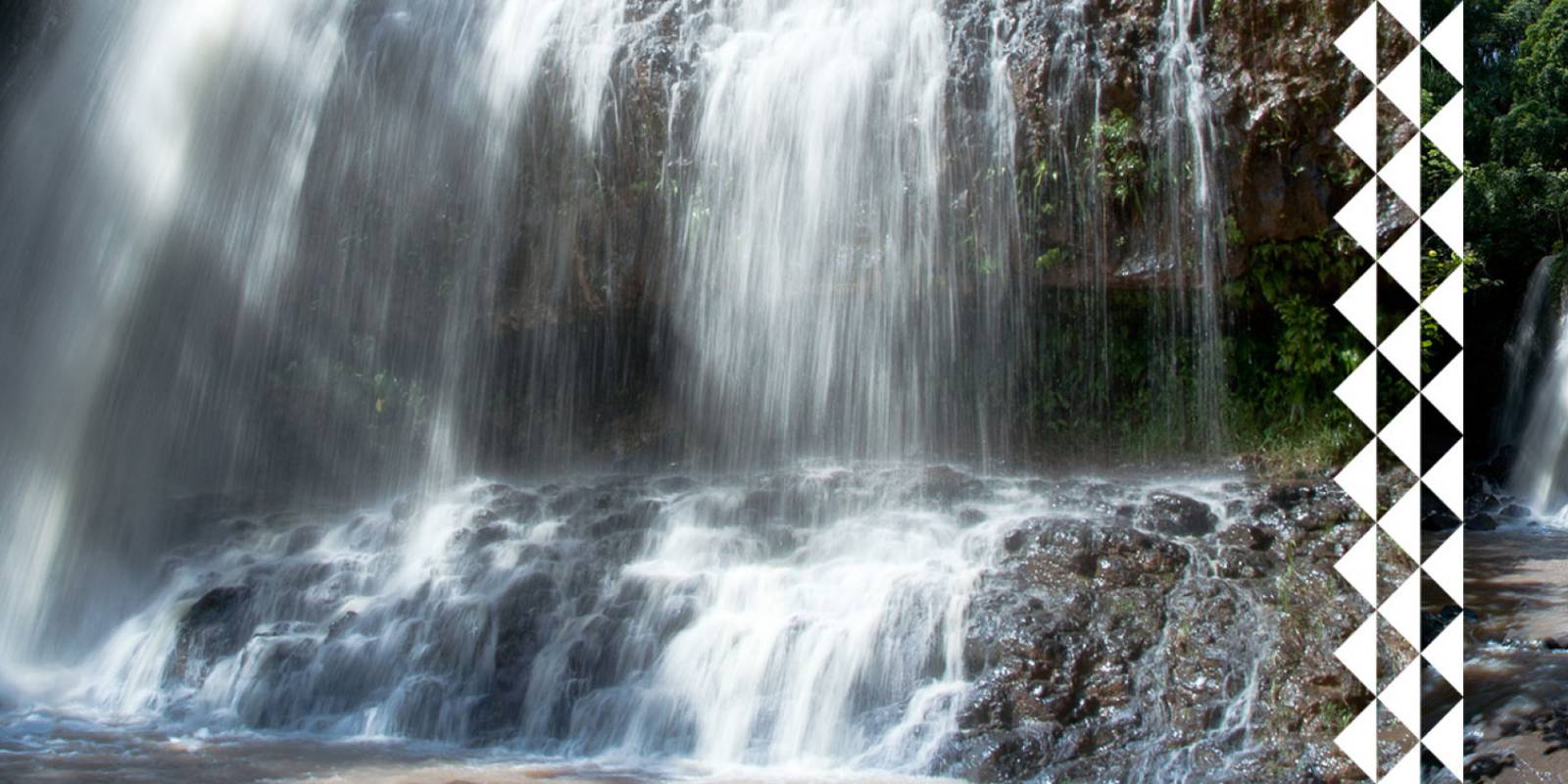
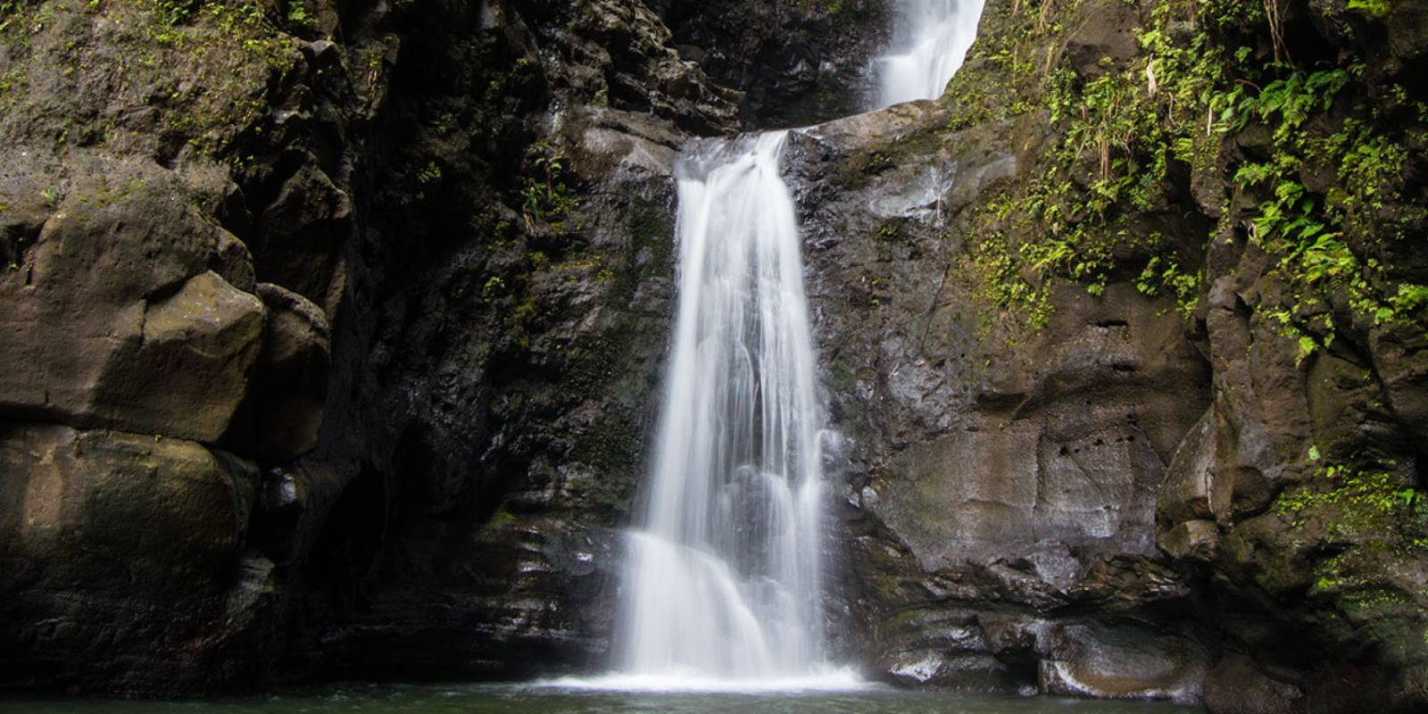
Kalihiwai Falls is a two-tiered waterfall on Kauai's north shore that you can see without leaving your car. No hiking required. Just drive to the bridge over the Kalihiwai River and look up.
Viewing the Falls
The falls are visible from the Kalihiwai Bridge on Highway 56, between Kilauea and Princeville. The best angle is from the bridge when heading toward Princeville (westbound). There used to be a pullout near the bridge, but it has been closed.
Walking across the bridge for a better look is not safe given the narrow road and fast-moving traffic. View from your vehicle or find a safe spot to pull over before or after the bridge.
When to Visit
The falls run best after heavy rain. During dry spells, the flow can thin to a trickle. Kauai's north shore gets plenty of rain, so chances are good during winter and spring months. After a big storm, the falls run wide and powerful.
The falls are on private land, so there is no legal trail access to the base. What you see from the bridge is what you get. Some guided horseback riding and kayak tours in the area pass near the falls for a closer perspective.
Photo Tips
Shoot from the westbound lane side of the bridge for the best framing. Morning light works well since the falls face east. A zoom lens helps pull in detail on the cascades. Overcast skies actually produce better waterfall photos than harsh midday sun.
The falls are just past mile marker 25 on Highway 56 — a smaller unnamed waterfall near the marker comes first, so don't mistake it for the main event. You'll cross the bridge on your way to Princeville and Hanalei. Easy to catch on a north shore day trip.
Explore smarter
Turn this stop into a better day plan.
Use maps, timing, access checks, and current conditions before adding another stop to the route.
Founder & certified Hawai'i travel expert with 20+ years in Hawai'i tourism, University of South Carolina climate-research training, and NOAA weather-station experience.
Heavy rain from the past day is clearing out tonight. You'll see scattered showers Friday morning—lighter and less frequent than what came through—then dry trade winds move in and stick around through at least the middle of next week.
Windward and upland areas will still catch occasional brief showers even as things dry out, but leeward sides turn partly cloudy to mostly clear. Moderate surf holds on south, north, and west-facing beaches through the weekend, close to warning strength. Winds stay gusty through Friday as the system pulls away, then ease once the trades lock in.
Beach days and snorkeling on leeward shores start looking good Saturday. Summit trips and exposed hikes are best waited until winds ease this weekend.
0:000:55
Voice
Read the transcript
Heavy rain from the past 24 hours is ending tonight. You'll catch scattered showers through Friday morning—lighter and thinner than what just passed. Trade winds take over after Friday and hold steady through the middle of next week, bringing drier conditions and partly cloudy to mostly clear skies on the leeward side.
Windward areas will still see brief showers even as things dry out. Moderate surf hits south, north, and west-facing beaches through the weekend, close to warning levels on the south shore but not quite there. Gusty winds persist tonight and Friday, especially near mountains and exposed coasts, then ease once the trades settle.
Leeward beaches and snorkeling spots turn prime starting Saturday. Save the summit drive and ridge hikes for when winds ease this weekend.
0:000:49
Voice
Read the transcript
Heavy rain from the past 24 hours is ending tonight. You'll see scattered showers through Friday morning, but they're tapering off and becoming lighter. After Friday, dry trade winds settle in and hold through at least the middle of next week. Windward and upland areas will still catch occasional brief showers, but leeward sides turn partly cloudy to mostly clear. Moderate surf is on south, north, and west-facing beaches through the weekend—close to warning levels. Winds stay gusty through Friday as the system moves away, then ease once trades settle in. Plan leeward beach days and snorkeling for Saturday onward. Summit trips and exposed hikes are best waited until winds ease this weekend.
0:000:54
Voice
Read the transcript
Heavy rain from the past 24 hours is ending tonight. You'll catch scattered showers through Friday morning—lighter and brief—then trade winds move in and dry things out through at least the middle of next week.
Windward and upland spots will still see occasional showers even as conditions clear, but expect partly cloudy to mostly clear skies on leeward sides. Moderate surf holds on the south, north, and west-facing beaches through the weekend, close to warning levels but not quite there. Winds stay gusty tonight and Friday near the mountains and coast, then settle once the trades take hold.
If you're planning beach time, leeward shores are your best bet starting Saturday. Summit trips and exposed hikes are best waited until winds ease this weekend.
Created with AI from the official NWS forecast discussion · verify with NWS before heading out
Created with AI from this HawaiiGuide page and read by a computer-generated voice. Double-check fees, hours, and reservations on the full page before you head out. Hawaiian pronunciation is tricky for synthesized speech and a few words may land slightly off; mahalo for your patience as we keep refining.
Mele and Kani are computer-generated voice options chosen for clarity and warmth.
Get Your Free Hawaii Visitor Guide
Enter your email and we'll send you instant access to our free 2026 Hawaii Starter Guide + Summary Guidesheets.