Hawaiʻi Guide · Audio Driving Tour
East Oahu Coastal Drive BETA
A 25-mile half-day drive along Kalanianaʻole Highway and around the southeast tip of Oahu — Diamond Head, Hanauma Bay, Halona Blowhole, Sandy Beach, Makapuʻu Lookout, Waimānalo, Lanikai. Ends at one of the most photographed beaches in Hawaii. ~7 curated stops.
25 miles
36 min driving
7 curated stops
Free AI-narrated tour
36 min
driving time
25 mi
total distance
7 stops
curated stops
~4h
suggested day
We may link to trusted Hawaiʻi resources at no extra cost to you.
Route Map
7 stops
·
active stop
Loading map…
Build your own route
Pick a preset or tap the ✓ Include chip on any stop below to customize.
7
of 7 stops selected
-
Intro
Intro
Show transcript
The East Oahu coastal drive runs from Diamond Head out around the southeast tip of the island and up the Windward Coast to Lanikai — about 25 miles of Kalanianaʻole Highway, also called Hawaii Route 72. It's a classic half-day drive: lookouts on the south coast, the protected snorkel cove at Hanauma Bay, the volcanic Halona Blowhole, a shorebreak beach at Sandy, the lighthouse trail at Makapuʻu, then up and over Makapuʻu Point into the Windward side and the long flat stretch through Waimānalo to Lanikai. Plan three to four hours if you stop at a few overlooks, a full day if you want to swim, snorkel, or hike. Two practical things up front. Hanauma Bay requires an advance reservation — released 48 hours out at gohanaumabay.org, $25 per adult, residents free with ID, and the bay is closed Mondays and Tuesdays. Skip it if you don't have a reservation. Second, parking at Lanikai is residential-permit only on most streets — you'll have to park at Kailua Beach Park and walk over the hill, about 10 minutes. Gas up before you start; the next reliable station is in Hawaiʻi Kai shopping center, about 8 miles in. The guide will announce each stop as it comes up. -
 72MILE0
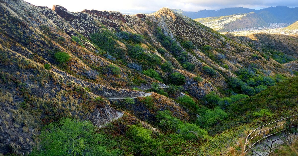
Diamond Head State Monument. Reservation required for the trail (non-residents). Lookout is the road pull-off on the south side, free, no reservation needed. The volcanic tuff cone is roughly 300,000 years old.
Approach Cue (~12-15 sec)Show transcript
Diamond Head coming up on the makai side — the volcanic tuff cone that defines the Waikīkī skyline. Two ways to experience it. The trail to the top is inside the crater (separate entrance off Diamond Head Road) and requires advance reservation for non-residents — gohaniwaii.com, $5 per person plus $10 vehicle, kid-friendly but a steep 0.8-mile climb each way. The lookout pull-off on the makai side of the road south of the crater is free, no reservation, and gives you the photograph from outside.Arrival Narration (~45-60 sec)Show transcript
Diamond Head — Lēʻahi in Hawaiian, "brow of the tuna" — is what remains of a single explosive volcanic eruption about 300,000 years ago. The hill itself is the rim of an ancient tuff cone, formed when magma met seawater at the surface and the steam blew the whole thing up. The British whalers who arrived in the 1800s saw calcite crystals in the lava on the slopes and thought they'd found diamonds — they hadn't, but the name stuck. If you're here on a reservation and have the trail tickets, the climb to the summit is 0.8 miles each way, paved at first, then a series of WWII-era concrete stairs and a tunnel to the bunker at the top. The view from the summit is the best skyline photograph of Honolulu. Plan an hour, bring water, wear closed shoes. If you're driving by, the makai-side pull-off about half a mile past the entrance gives you the iconic exterior shot — Waikīkī to the west, the volcanic cone rising directly above. The next stop is Hanauma Bay, about eight miles east on Highway 72. -
 15 min from previous stop · 8 mi72MILE8
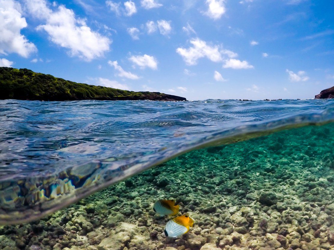
Hanauma Bay Nature Preserve. Reservation REQUIRED — gohanaumabay.org, released 48hr out, $25/adult non-resident + $3 parking, residents/military free, closed Mon+Tue. Mandatory 9-min orientation video before descent.
Approach Cue (~12-15 sec)Show transcript
Hanauma Bay coming up on the makai side. Important — you cannot enter without an advance reservation. They release tickets 48 hours out at gohanaumabay.org and they're gone within minutes. Closed Monday and Tuesday. If you don't have a reservation, keep driving — the parking attendant will turn you around at the lot. Walk-up tickets are not available.Arrival Narration (~45-60 sec)Show transcript
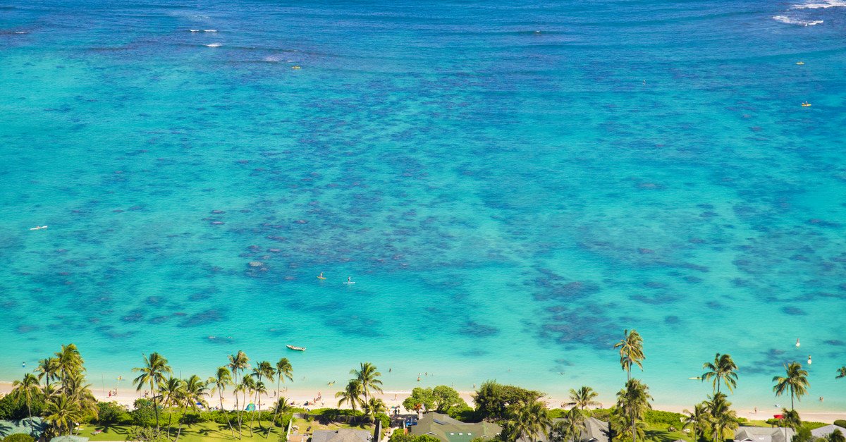
Hanauma Bay sits inside an ancient volcanic crater that has been breached by the sea, forming a curved reef-protected cove that's arguably the best beginner snorkel spot on Oahu. The bay was made a Marine Life Conservation District in 1967 — fishing prohibited, feeding prohibited, the reef strictly protected. As a result, fish populations are dense: yellow tangs, parrotfish, butterflyfish, moorish idols, and the occasional honu (green sea turtle). Reef-safe sunscreen is mandatory and enforced — they sell it at the entrance if you don't have any. Before you can descend the path to the beach, you watch a 9-minute orientation video about reef etiquette, conservation, and ocean safety. It's free, it's mandatory, and it's actually useful. The walk down to the bay is 200 vertical feet on a paved switchback. There's a tram for the climb back up, $2 each way, cash only. Parking is $3, separate from the entry fee. Plan three to four hours total if you snorkel. The next stop is the Halona Blowhole, two miles east. -
 4 min from previous stop · 2 mi72MILE10
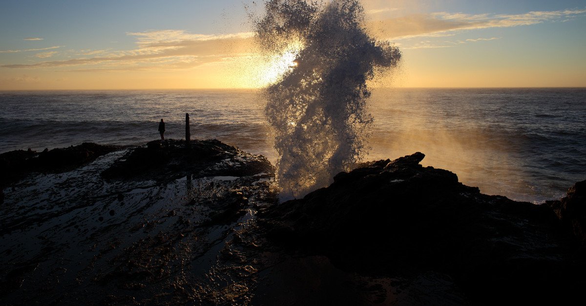
Halona Blowhole + Halona Cove ("Eternity Beach" from From Here to Eternity). Lava tube hole that geysers seawater on the right swell. Cove below is small, swimmable in summer, lethal in winter. Lookout is the parking pull-off.
Approach Cue (~12-15 sec)Show transcript
Halona Blowhole coming up on the makai side. Pull into the lookout parking lot. Two things to look at — the blowhole, which on a decent south swell shoots seawater 20 to 30 feet in the air, and Halona Cove just below it, the small protected pocket beach famous from the 1953 movie "From Here to Eternity." The famous kissing-on- the-sand scene was filmed in that cove. Don't try to walk down to it — the descent is steep, dangerous, and discouraged.Arrival Narration (~45-60 sec)Show transcript
The Halona Blowhole is a lava tube — a hollow channel left when a lava flow cooled around a still-flowing core — that emerges at the shoreline. When swell pushes through the tube and meets the right wave timing, the trapped air and water shoot out the top in a geyser. Best on south or southeast swell, summer through fall. The blowhole can also be flat for hours when the timing isn't right — patience helps. Stay behind the railing. People have been killed climbing down for closer photos. Halona Cove, the small beach you can see directly below, is also called Eternity Beach because of the From Here to Eternity scene — Burt Lancaster and Deborah Kerr, kissing on the sand as a wave washes over them, was filmed there in 1953. The cove itself is swimmable on calm summer days, but the descent path is unmarked, treacherous, and the cove gets cut off by the tide. The lookout is the experience. Sandy Beach is half a mile ahead. -
 1 min from previous stop · 0.5 mi72MILE11
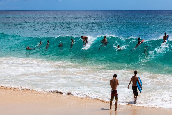
Sandy Beach Park. Famous shorebreak — neck-and-spine injury rate is one of the highest in the state. Local bodyboarders only in winter; flat-water beach in calm summer. President Obama's home beach.
Approach Cue (~12-15 sec)Show transcript
Sandy Beach coming up on the makai side. Pull-off parking on the shoulder. You'll see the wave even from the road — a hard, fast shorebreak that closes out on the sand in shallow water. This is one of the most famous shorebreak spots in the world. It's also one of the most dangerous swimming beaches on Oahu. Most readers should watch it from the sand, not enter the water.Arrival Narration (~45-60 sec)Show transcript
You're at Sandy Beach, the home break of every East Oahu kid who's ever owned a bodyboard. The wave here is a shorebreak — it breaks directly on the sand in less than two feet of water — and it breaks hard. Bodyboarders read the closeouts, time the drop, and ride for a couple of seconds before slamming flat. People who don't read it right break necks here. Hawaii Lifeguard Association data has Sandy as one of the top three most-injurious beaches in the state. The general rule for visitors: walk on the sand, watch the bodyboarders from a safe distance, don't enter the water unless conditions are genuinely flat and a lifeguard tells you it's okay. The lifeguard tower at the south end is staffed every day; ask there. Despite the shorebreak danger, the beach itself is wide, photogenic, and one of the favorite local beaches of President Obama, who grew up in Honolulu — there are photos in the East Oahu library of him bodyboarding here as a teenager. Makapuʻu Lookout is two miles ahead. -
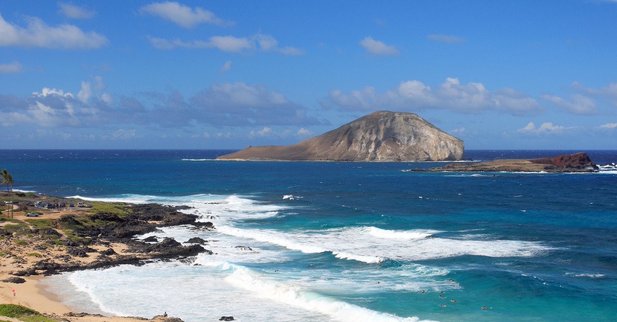
4 min from previous stop · 2 mi72MILE13
Makapuʻu Point Lookout (highway pull-off, free, no walk required). The Makapuʻu Lighthouse Trail is a separate parking lot 0.5 mi back; 2-mile paved round trip, 500 ft gain, no shade — peak whale-watching spot Dec-Apr.
Approach Cue (~12-15 sec)Show transcript
Makapuʻu Lookout coming up on the makai side — pull-off, free, no walk required. The view is the postcard: the Windward Coast unrolling north, two small offshore islands (Mānana / "Rabbit Island" and Kāohikaipu), Sea Life Park below the road, and Waimānalo Beach in the distance. If you have an hour, the Makapuʻu Lighthouse Trail starts from a separate parking lot half a mile back — paved 2-mile round trip, 500 feet of climb, prime whale-watching from December through April.Arrival Narration (~45-60 sec)Show transcript
Makapuʻu Lookout is the visual transition point of the drive. From here you've left the south coast and you're looking down the Windward Coast — the green Koʻolau mountains on your left running 30 miles north, the Pacific on your right, two offshore islands at your feet. Mānana, the bigger of the two, is also called Rabbit Island because the silhouette from this angle looks like a rabbit head with the ears laid back. The smaller one is Kāohikaipu. Both are seabird sanctuaries, off-limits to landing. The lighthouse on the cliff to your right — the squat red-roofed building — is the Makapuʻu Lighthouse, built in 1909, automated since the 1970s. The paved trail to the lookout above the lighthouse takes about 45 minutes round-trip, gains 500 feet on a paved road, and there is essentially no shade — bring water, especially in summer. From December through April it's the best land-based whale-watching spot on Oahu — humpback whales come within a few hundred yards of the cliff. From here, the road drops down to Waimānalo. The beach is about three miles ahead. -
 6 min from previous stop · 3 mi72MILE16
Waimanalo Beach is 3 miles of gentle white sand. Less crowded than Lanikai, swimmable year-round, lifeguarded. The "country" of Windward Oahu — many local-only feel restaurants in town.
Approach Cue (~12-15 sec)Show transcript
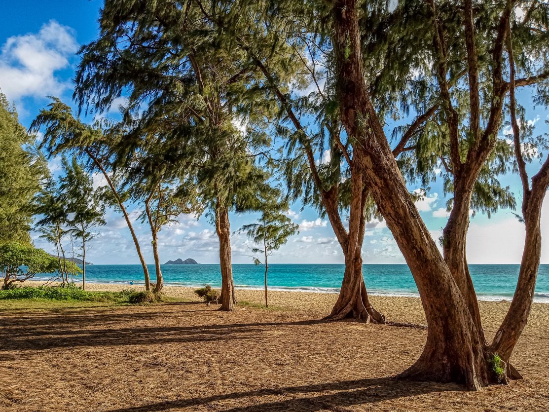
Waimānalo Beach coming up on the makai side. The full beach runs about three miles — Bellows Field Beach Park to the south, Waimānalo Beach Park in the middle, Sherwood Forest at the north end. Any access point gets you onto the same long stretch of soft white sand. Less crowded than Lanikai, calmer than Sandy Beach, lifeguarded at the main park.Arrival Narration (~45-60 sec)Show transcript
Waimānalo is "the country" — a local working town, less developed than the rest of Oahu's coast. The beach itself is roughly three miles of soft white sand backed by ironwood trees, with Mānana Island visible to the south and the Mokulua islets just visible in the distance to the north. Swimming is generally calm year-round — shore break is much gentler than Sandy Beach, and the lifeguarded stretch in front of Waimānalo Beach Park is appropriate for kids and average swimmers. The town behind the beach has some of the best small-operation food on the Windward side — Keneke's Plate Lunch on Kalanianaʻole Highway has been a local institution since 1985, cash only, no frills, big portions. Ono Steaks and Shrimp Shack across the street is a longtime competitor. If you want a sit-down meal, Bobby's Local Style is a few miles up the road. From here, the highway continues north into Kailua. Lanikai Beach, the final stop, is about three miles ahead. -
 6 min from previous stop · 3 mi72MILE19
Lanikai. Residential-permit street parking. Park at Kailua Beach Park (free) and walk 10 min over Wailea Point. Beach has been losing sand to erosion since the 1990s — at high tide some stretches are seawall.
Approach Cue (~12-15 sec)Show transcript
Lanikai coming up — the postcard. One important practical note: Lanikai is a residential neighborhood and the streets are permit-only parking. Don't park on Aalapapa Drive or Mokulua Drive. Park at Kailua Beach Park, which is free and a 10-minute walk over Wailea Point to the south end of Lanikai Beach. The walk is the cost of admission. The Mokulua Islets — the two small twin islands offshore — are the iconic photograph.Arrival Narration (~45-60 sec)Show transcript
You're at Lanikai, regularly named one of the best beaches in the world. The water is turquoise, the sand is soft, the offshore Mokulua islets — Mokunui and Mokuiki — sit a half mile out as the visual anchor. The name "Lanikai" was made up by a 1920s real estate developer who got the Hawaiian wrong — it should be "kailani," which means "heavenly sea." Lanikai literally translates to "marine sky," which is grammatically backwards. The error stuck and the neighborhood is still called Lanikai. The beach itself has been losing sand for the last 30 years. Climate change, sea level rise, and seawalls built by individual homeowners to protect their properties have starved the beach of natural sand replenishment. At low tide, the south end of the beach is a long curve of white sand. At high tide, parts of it are now just water against seawall. The morning sun hits the water at the perfect angle from about 7 to 10 AM — that's when you'll get the photograph. After that, head shade. The Mokulua islets are reachable by kayak from Kailua Beach Park (rentals at the park entrance), about a 30-minute paddle each way; you can land on Moku Nui (the larger island) but Moku Iki is closed to landings. From here, you're done with the drive. Kailua town is about a mile back the way you came — plate lunch at Kalapawai Café, açaí bowls at Lanikai Juice, and the Kailua-side Whole Foods if you need anything before heading back to Waikīkī. The drive home is the H-3 freeway over the Koʻolau Mountains — about 25 minutes back to Waikīkī, or 40 to the airport. -
Outro
Outro
Show transcript
That's the East Oahu drive. From Diamond Head, around the southeast tip past Hanauma, Halona, Sandy, and Makapuʻu, then up the Windward side through Waimānalo to Lanikai. Driving back to Waikīkī, the fastest route is to head out of Kailua on Hwy 61 (Pali Highway) or H-3 — both cut through the Koʻolau Mountains via tunnel, 25 to 30 minutes door to door. The Pali Highway is older, slower, more scenic; H-3 is faster but the engineering is more impressive than the view. If you have an extra hour, the Pali Lookout at the top of Hwy 61 is worth the stop — it's the historical site of the 1795 Battle of Nuʻuanu, where Kamehameha I unified the Hawaiian Islands by driving the Oahu defenders off the cliff. It's also windy enough to lean against. Tomorrow — if you've got the energy — the North Shore Drive is the other Oahu must-do. Different coast, completely different vibe.
AI-narrated audio synthesized by ElevenLabs, voiced by Hoku (feminine) and Honu (masculine). Hoku and Honu are Voice Library donors, not native Hawaiian speakers. Some pronunciations may land slightly off — mahalo for your patience as we refine.
Try out our AI Powered
Search & Chatbot →
Get Your Free Hawaii Visitor Guide
Enter your email and we'll send you instant access to our free 2026 Hawaii Starter Guide + Summary Guidesheets.