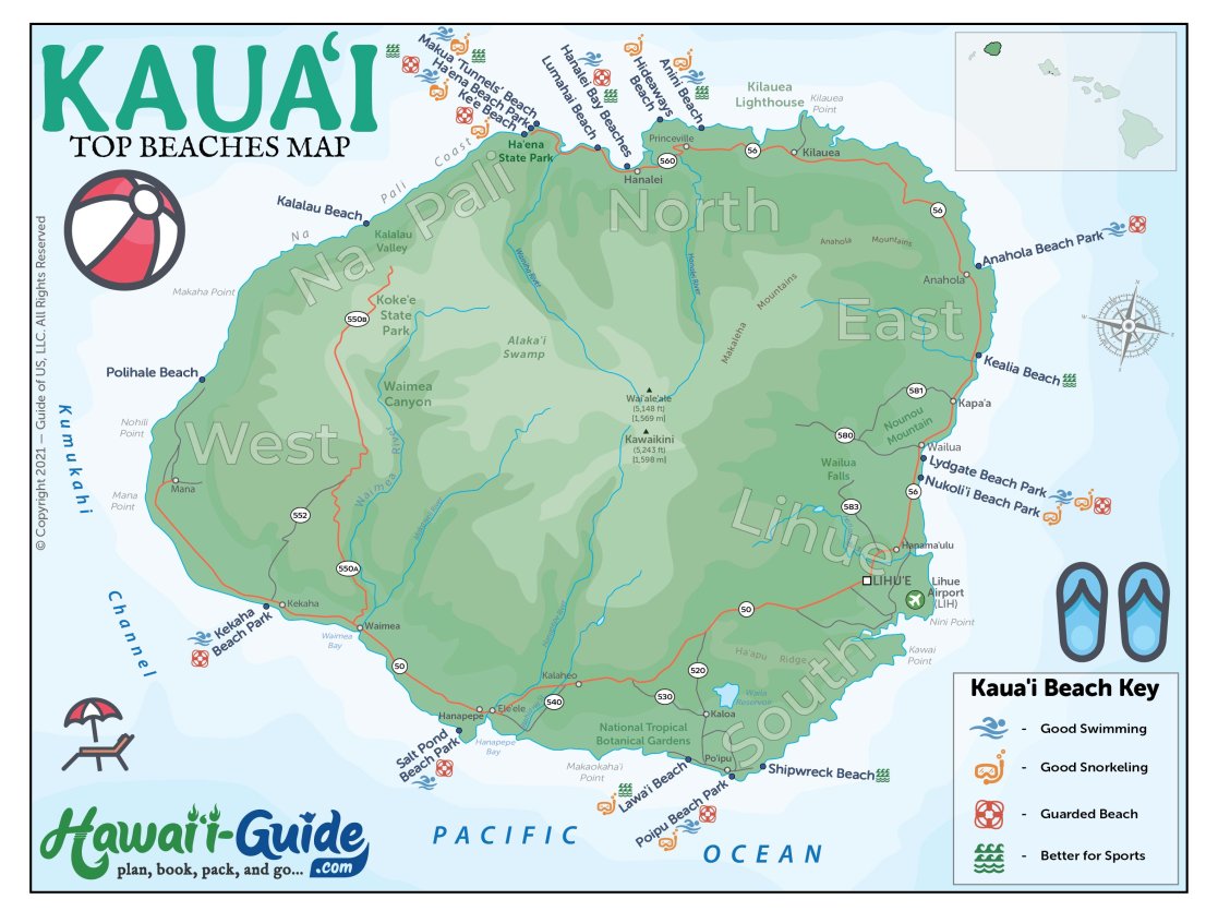

From the towering cliffs of the Na Pali Coast to the picturesque Hanalei Bay, Kauai is sure to take your breath away. To help you make the most of your visit, we’ve put together a selection of Kauai travel maps, including a Kauai top beaches map.
With these maps, you’ll easily find your way to all the best places Kauai has to offer. So start planning your Kauai adventure today and enjoy the beauty of the Garden Island!
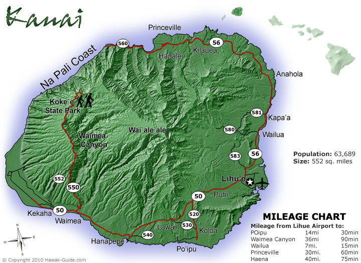
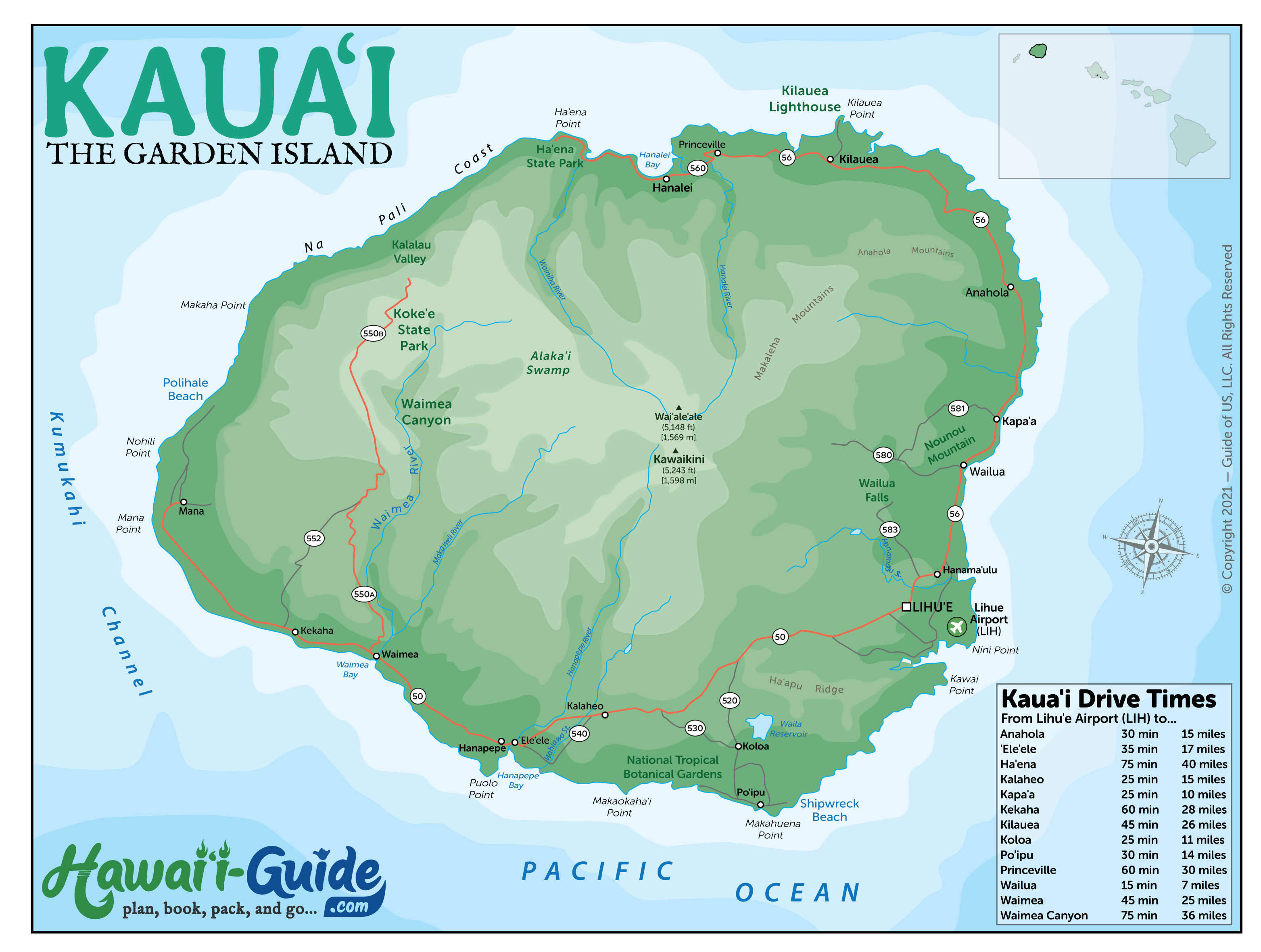
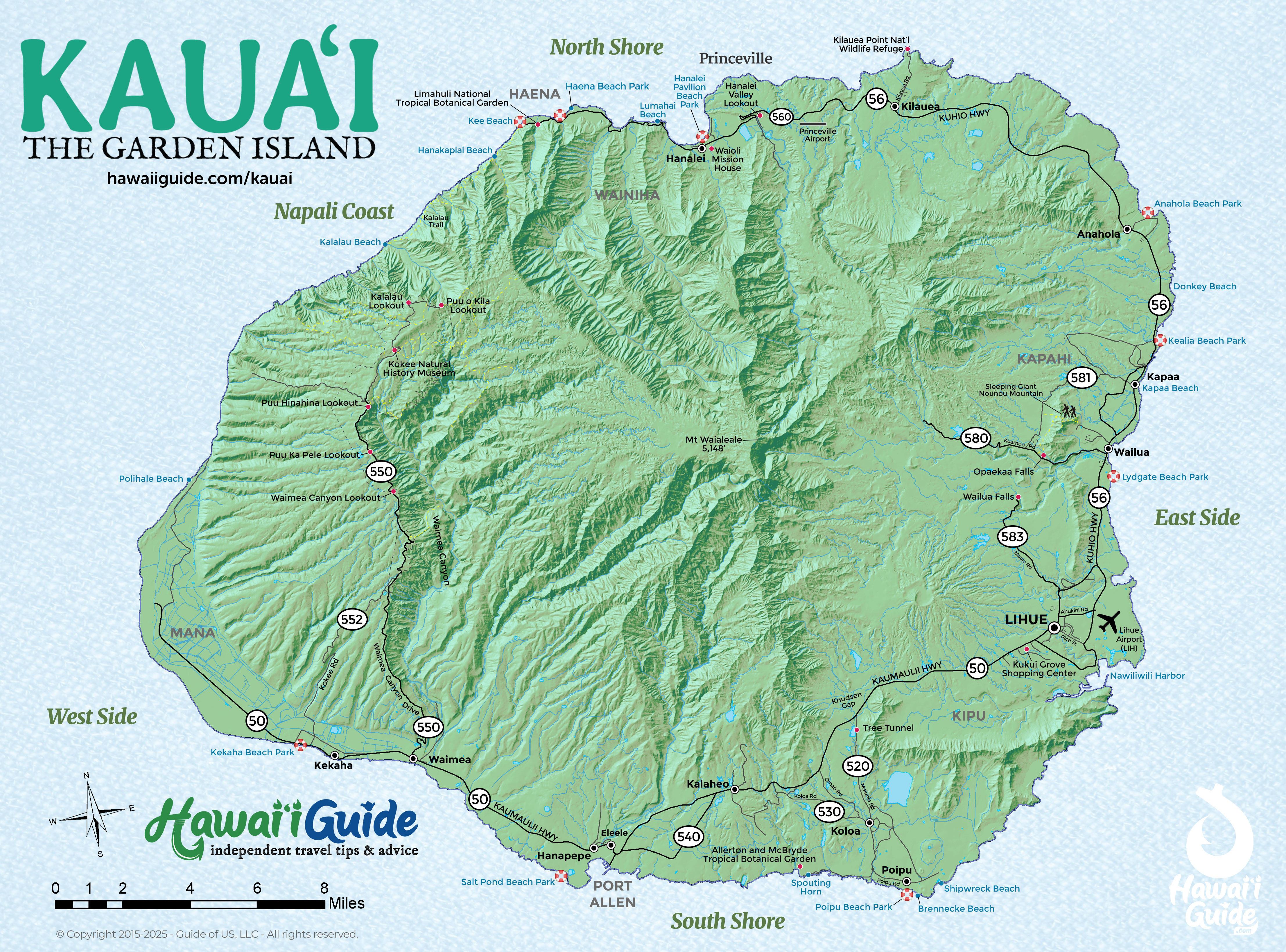
Kauai Regions at a Glance
Kauai is compact — only 25 miles across — but you can't drive all the way around it. The Na Pali Coast cuts the road on the northwest side, so getting from the north shore to the west side means backtracking through Lihue. Five regions, each with a distinct feel.
North Shore (Hanalei / Princeville / Ha'ena)
The dramatic, lush, rain-soaked side. Hanalei Bay is one of the most beautiful bays in the world — a crescent of sand backed by jagged green mountains. Princeville has resorts and golf courses on the cliffs above. The road ends at Ke'e Beach, which is the trailhead for the Na Pali Coast's Kalalau Trail. Ha'ena State Park requires parking reservations via gohaena.com.
East Side (Lihue / Kapa'a / Wailua)
Where the airport is and where most of the island's population lives. Lihue has big-box stores, the main harbor, and Kalapaki Beach. Kapa'a has the Coconut Coast — a stretch of condos, restaurants, and bike paths along the shore. Wailua Falls (the opening shot from Fantasy Island) and the Wailua River kayak trip to Secret Falls are here. Practical, central, less glamorous than north or south.
South Shore (Poipu / Koloa)
The sunny, dry resort area. Poipu Beach is Kauai's most popular family beach — calm water, good snorkeling, monk seals hauled out on the sand. The Grand Hyatt and Sheraton anchor the south coast. Old Koloa Town has shops and restaurants in restored plantation buildings. Spouting Horn blowhole is a quick stop. This side gets the most consistent sun on the island.
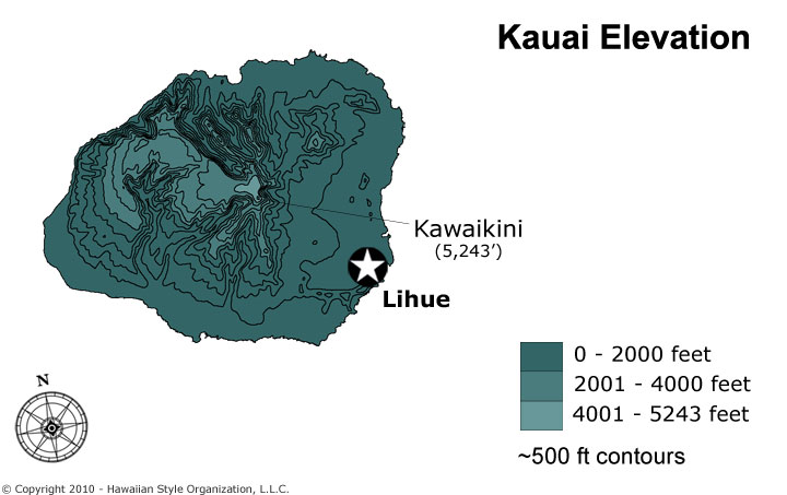
West Side (Waimea / Kekaha / Polihale)
The dry, remote, least-touristy side. Waimea town is the gateway to Waimea Canyon (Highway 550 up the mountain). Kekaha has a long, empty beach. Polihale State Park — at the end of a rough dirt road — is a 17-mile stretch of sand ending at the Na Pali Coast cliffs. Bring everything you need; there are no services out here.
Na Pali Coast (No Road Access)
Seventeen miles of sea cliffs rising up to 4,000 feet with no road. Accessible only by boat tour, helicopter, kayak, or hiking the Kalalau Trail. This is what makes Kauai's map unique — the gap in the road is the most spectacular coastline in Hawaii.
Kauai Driving Times Between Destinations
Kauai is small but the roads are two-lane and winding. There is no highway system like Oahu's H-1. Budget more time than the miles suggest, especially on the north shore where the road narrows past Princeville.
| From | To | Distance | Drive Time |
|---|---|---|---|
| Lihue Airport (LIH) | Poipu / South Shore | 14 mi | 25 min |
| Lihue Airport (LIH) | Princeville / North Shore | 28 mi | 45-50 min |
| Lihue Airport (LIH) | Ke’e Beach / Ha‘ena | 38 mi | 1 hr 15 min |
| Lihue Airport (LIH) | Waimea Town | 25 mi | 50 min |
| Poipu | Waimea Canyon Lookout | 25 mi | 55 min |
| Poipu | Hanalei Bay | 37 mi | 1 hr 10 min |
| Kapa‘a | Hanalei Bay | 18 mi | 35 min |
| Waimea Town | Polihale State Park | 17 mi | 40-50 min* |
*Polihale requires a rough unpaved road for the last 5 miles. 4WD recommended, though some rental cars make it in dry conditions. Check conditions before attempting.
The single most important thing about Kauai driving: you cannot loop the island. The Na Pali Coast has no road. If you are staying in Poipu and want to visit the north shore, budget 2.5 hours of driving round-trip. Compare Kauai rental car rates.
Updated Kauai Travel Map Packet + Guidesheet
Updated with a new high-resolution Kauai map. Includes most major attractions, all major routes, airports, and a chart with estimated Kauai driving times.
PDF packet now additionally includes a Kauai Beaches Map.
Our 2026 Kauai Summary Guidesheet includes the top must-see & do attractions, best times to visit, where to stay briefing, airport detail, a monthly weather summary, and where to find the most noteworthy local ono 'grindz' (best eats) on Kauai.
-File is formatted as a print-ready PDF document
Printable Free Kauai Hawaii Maps
Click any map to view full size. Download and print for your trip.