09-30-2022

Wailua River Cultural Sites

Founder & certified Hawaii travel expert with 20+ years of experience in Hawaii tourism.
Aloha! This article may link to trusted Hawaii resources at no extra cost to you. Mahalo for your support!
Wailua means ‘two waters,’ and the Wailua River area was known to be one of the largest ahupu’a (land divisions) on Kauai. It was very much one of the primary religious and political centers of the island. The 2800-acre Great Sacred Wailua area was chosen for its royal purpose due to its access to nearby marine resources, excellent canoe landings and moorings, as well as the fertile land for agricultural purposes. The region was named Wailuanuiaho’ano (the Great Sacred Wailua of the chief Ho’ano) and extended all the way from the ocean at Wailua Bay to the high mountain ridges of Kalepa and Nounou. Wailuanuiaho’ano was a great chief who lived in the 14th century AD. Centuries later, King Kaumuali’i, who was the last King of Kauai before the island were unified during King Kamehameha I’s reign, favored the Wailua area and preferred to reside there.
The Hawaiian Ali’i were the ruling high chiefs of the islands, who governed the land. Ali’i was name given to the original Tahitian islanders who conquered the Hawaiian Islands in the mid to late 13th century AD. Later, after mixing of bloodlines, the term ali’i was used to describe anyone of the ruling class. This elite class of people ruled until 1893 when the last queen of the dynasty - Queen Lili’uokalani - was overthrown by the United States government.
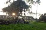
The legacy of the Ali’i still stands today and can be observed in the seven important sacred sites that are dotted along the Wailua River, all the way from the mouth of the river at Lydgate Park, to the summit of Mt Wai’ale’ale, the second highest mountain in Kauai and one of the wettest spots on earth. These sites are actually aligned from the shoreline to essentially the top of the island for spiritual purposes, and they include the remains of various structures that contain a great deal of history and significance. They include heiau (places of worship), pu’uhonua (places of refuge) and birthing sites. In ancient times, chiefs would travel through thick groves of lehua, koa and sandalwood trees to access the heiaus.
>The first site of significance is Hikinaakala Heiau, (which means Rising of the Sun) built approximately 1,200 years ago at the river mouth of what is today called Lydgate Park. It is said to be located at the exact point where sunlight first touches the eastern shore of the island every morning. It was also oriented to the North Star. The walls of the heiau were once 6 feet high and 11 feet wide. This Heiau includes the Hauola place of refuge, which can be likened to the purpose of a jail where people who broke a kapu (law) would be sent to find refuge from being killed which was the likely outcome of such an act. They were allowed to leave when they took responsibility for their actions. Fascinating Ki’I Pohaku (ancient Hawaiian petroglyphs) can also be found at the mouth of the river near the heiau.
The Kukui heiau is also a cultural site that is a part of Wailuanuiaho’ano. It is situated across the rivermouth from Hauola, at Alakukua Point. Apparently it was a navigational heiau – oral traditions indicate that the site served Polynesian navigators on canoe voyages to and from Kauai.
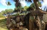
The next Hawaiian temple on the Wailua River is Mala’e Heiau (also known as Makaukiu or Mana Heiau) - a huge, 400-foot long rectangular heiau west of the highway on the south side of the river. The entire site encompasses about 2 acres and is one of the oldest and largest heiaus. This was a luakini heiau where human and animal blood sacrifices were made. These types of heiaus were established by Pa’ao, who was the chief that led the migration of Tahitian people onto the Hawaiian Islands. According to legend, it was the Menehune who originally constructed the heiau 1,500 years ago by forming a long line of people and passing rocks to the final location.
Further upstream and on the north side of the river, heading up Kuamo’o Rd (Rt 580) about a quarter–mile from Highway 56m towards the mountains, stands the remains of Holoholoku Heiau. This is the most restored and also one of the oldest heiaus on Kauai. It is a fairly small site compared to the other heiaus in the region. Meaning ‘run, run stand fast’, Holoholoku was also used for human sacrifice but mostly for prisoners of war. Ironically, the sacred birthing site Pohaku Ho’ohanau (Royal Birthstone) is located right near this temple. This is the place where the royalty of Kauai would give birth and bury umbilical cords (piko) and afterbirth, as a means to ensure the health of the child.
Proceeding further uphill along Kuamo’o Rd , the next site you will come to is the Poli’ahu Heiau on the left side of the road and an overlook of Opaeka’a Falls and Stream a little further up. Be sure to stop first at the Heiau as it is well worth a look. Another luakini heiau, it is believed that it was also originally built by the Menehune, who were the original inhabitants of the Hawaiian Islands that lived peacefully before the Tahitians arrived on the islands. Originally, there were structures within Pilo’ahu that included a lele (altar), a hale pahu (temple drum house) and an ‘anu’u (oracle tower). Just downhill from Polahu there is a path that leads towards petroglyphs and Bellstones. A Bellstone is a large rock that is hollow in parts - formed by volcanic activity – that was rung to announce important events such as royal births or to warn of danger.
The fifth sacred site of the ancient ahupu’a is said to be located in the valley near the Hindu Temple, however there is no public access allowed to this site. The locations of the fifth and sixth heiaus are not publicly disclosed. The seventh sits atop the ‘crown of Kauai’ on the summit plateau of Wai’ale’ale; an area which is essentially inaccessible.
The sacred heiaus were no longer officially used for religious purposes since the late 1800’s, and in the 1900’s rocks were removed and used in road building, which diminished many of the sites significantly. In 1962 some of the heiaus on the Wailua River became National Historic Landmarks. Nowadays, many of these places are cared for meticulously by local Hawaiian people, many of whom still regularly use the heiaus. The Wailua River cultural sites are a significant and important part of Hawaii’s history, and must be respected accordingly. Never remove rocks, place items or sit on the rocks in a heiau. Some heiaus are ‘kapu’ and entry is forbidden, so if in doubt it is best to refrain from walking inside.
Published by: John C. Derrick
Founder & certified Hawaii travel expert with 20+ years of experience in Hawaii tourism.
Geolocation Data
Geographic Coordinates
Latitude: 22.0483333
Longitude: -159.3391667
Hawaii Safety Information
Wailua River Cultural Sites Photo Gallery


Recommended Tours Nearby
Affiliate Disclosure: We may earn commissions from some travel partners (like Amazon or Expedia) which helps us maintain this site. These links are at no extra cost to you and don't impact our honest & unbiased recommendations. Remove all the ads →
×
![]()
Try out our AI Powered
Search & Chatbot →