03-02-2025
Honopu Ridge Trail
Located within the West Region on Kauai
Aloha! This article may link to trusted Hawaii resources at no extra cost to you. Mahalo for your support!
NaPali Coast Trail
Koke'e and Waimea State Park
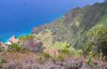
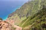
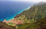
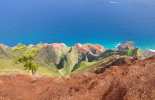
Honopu Ridge Trail is a 4.2 to 5 mile (round trip, depending on how far you go) hike that takes you to incredible views of Honopu Valley and a portion of the NaPali Coastline.
The total distance depends on how far you hike out on the ridge at the end, but we estimate that to the logical and safe stopping point it's about 2.4 miles one way. The trail drops about 1,400-1,950 ft. in elevation from the trailhead to the ridge; again, depending on how far you go out on the ridge. Check out our Google Earth Honopu Ridge Trail map for more an overview.
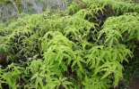
This is rated a difficult trail based on the fact that the trial, like Kalepa Ridge 'Trail,' l is not officially maintained. In our opinion, it is one of the best– though roughest– hikes on Kauai. While the trail is pretty short, it is no longer maintained by the park (due to Hurricane Iniki damage way back in 1992 and Hurricane Iwa in 1982) - so prepare to bushwack; the ferns are especially brutal on the legs if you're not prepared. Wearing long pants is a great way to get through the ferns (we personally love convertible cargo pants).
The main trail can sometimes become vague and you might be misled by several other smaller (hunters) trails that branch off from the main trail. This is especially true near the trailhead. Keep an eye out for the orange and pink ribbons that others have tied up to mark the trail. Sticks and branches are often laid across the wrong trails, so watch for them.
At the trailhead, just as you leave the road, take the left branch (under the large limb) to find the main trail. At approximately 10 minutes or so into the hike you'll come to a junction in the trail - you'll want to bear to the right at this junction and from that point follow the most worn portion of the trail (again, look for the orange and pink ribbons). If you find yourself at a stream bed (the left fork), go back and take the other fork which continues out onto the ridge. A GPS can come in really handy as well when retracing your steps out, as there are opportunities to get lost coming out, too.
Overall though, we feel the trail is fairly easy to follow and is well marked. Once you get through the initial "maze" it's very easy to follow the trail out onto the ridge.
While there is a good bit of descent in the first mile and a half, it's not that much different than many of the ridges in the area. Nualolo is probably steeper going down than Honopu; though Honopu does have some very steep areas.
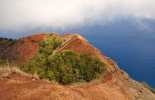
There are three major parts of the trail. The forest/fern portion of the trail, which terminates at an overlook of the valley mostly blocked by trees. From here the ridge descends steeply onto the ridge where the views get increasingly better as you hike up and down the hills along the ridge. Eventually, you'll come to a hill where the trail descends very steeply again onto the outer (third) portion of the ridge. This is where we'd advise you to stop, as the third and final portion of the ridge is very narrow and dangerous. The views from the end of the second portion of the trail are fantastic, and they won't get much better further out. If you do continue, use extreme caution as the trail is only two or three feet wide in places with a very steep drop off on either side and the ground itself is very crumbly and erosive. Experienced guides have been caught in small debris slides out here and have needed help to get back up to the top of the ridge.
If you happen to be someone who likes to jog across a knife-edge ridge with a several-thousand-foot precipice on both sides, the end of Honopu Ridge will give still give you pause to be mindful about how you proceed.

The good news is that on a good clear day it results in a view that is perhaps Kauai's greatest. The forests of Honopu Ridge are unique for the area, receiving less than 100 inches of rain per year; considerably less than the surrounding forests of Koke'e State Park. In any event, you may want to consult the rangers at Koke'e VC before heading out on this hike. (Be warned they may try to dissuade you from doing the hike since it's not an official trail).
Parking for this hike is located 4/10th of a mile past the 17 Mile Marker on Highway 550. The "parking lot" is on a curve, just a short ways past the Awa'awapuhi Trail trailhead. If you miss it, just park at Kalalau Lookout and hike the 1/4th of a mile back to the trailhead.
If you're looking for a better-maintained trail with similar views of NaPali and a gorgeous valley at the end, then consider the Nualolo Trail.
Don't forget to check our Koke'e State Park Hiking page for information on all the incredible trails inside the park. On that page, we've also posted a map of the entire area (Koke'e and Waimea State Parks) for you to download and print out at home. The Koke'e Lodge and Museum will also have maps available, but we'd definitely advise you to go ahead and review the map and become familiar with the area. The crisscrossing of trails and 4x4 roads can be confusing at first, but once you select your routes, it's not too bad. Feel free to contact us if you have specific questions.
Our Other Kauai Recommendations
Kauai is most definitely our favorite Hawaiian island to hike. Whether you're looking for a professional hiking guide or need some maps to take along, you'll find them right here. Also, you don't have to be a hard-core hiker to experience all the best Kauai sights, as many Kauai sightseeing tours are perfect for all ages and abilities.
Grab Your Free Travel Guides!
Kauai Intro Visitor Guide
+ Our Summary Guidesheet!
Includes the top must-see & do attractions, best times to visit, a monthly weather & visitor summary, and our tips on how to save when booking your car rental, tours, and activities. Plus, grab our free Kauai Summary Guidesheets. Check out our Updated Kauai Visitor Guides.
Honopu Ridge Trail Reviews
Guidereview:
A (based on 172 visitor reviews)Geolocation Data
Geographic Coordinates
Latitude: 22.14403388
Longitude: -159.6480865
Hawaii Safety Information
Honopu Ridge Trail Photo Gallery
Recommended Tours Nearby
Affiliate Disclosure: We may earn commissions from some travel partners (like Amazon or Expedia) which helps us maintain this site. These links are at no extra cost to you and don't impact our honest & unbiased recommendations. Remove all the ads →


