09-16-2022
Alakai Swamp Trail
Located within the West Region on Kauai
Aloha! This article may link to trusted Hawaii resources at no extra cost to you. Mahalo for your support!
Napali Coast Trail
Koke'e and Waimea State Park
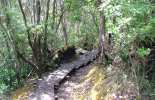
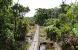
After two miles on the Pihea Trail is the junction with Alakai Swamp Trail. The scenery drastically changes from open valley to rainforest as you head into Alaka'i Swamp, the world's highest rainforest and swampland fed by the abundant precipitation on Wai'ale'ale's slopes. The trail is said to be the highlight of many visitors' journeys to the island, and it's one of our favorite hidden gems as well. As a bonus, in the last few years the trail has been greatly enhanced with boardwalks. No longer do hikers have to trudge through the mud to reach the magical lookout of Kilohana at the end of the journey.
To help clarify this junction and the two trails, we've created three maps below: one is a Pihea Trail map alone, one a Alakai Swamp Trail map alone, and one that shows the preferred route that combines the two (from Pu`u o Kila at the end of Highway 550 to Kilohana lookout), here known as the Pihea and Alakai Junction Trail map. Be sure to also check out our Google Earth file of this hike: Pihea and Alakai Swamp Trail
Kokee and Waimea State Park
Don't forget to check our Koke'e State Park Hiking page for information on all the incredible trails inside the park. On that page we've also posted a map of the entire area (Koke'e and Waimea State Parks) for you to download and print out at home.
The Koke'e Lodge and Museum will also have maps available, but we'd definitely advise you to go ahead and review the map and become familiar with the area. The crisscrossing of trails and 4x4 roads can be confusing at first, but once you select your routes, it's not too bad. Feel free to contact us if you have specific questions.
Our Other Kauai Recommendations
Grab Your Free Travel Guides!
Kauai Intro Visitor Guide
+ Our Summary Guidesheet!
Includes the top must-see & do attractions, best times to visit, a monthly weather & visitor summary, and our tips on how to save when booking your car rental, tours, and activities. Plus, grab our free Kauai Summary Guidesheets. Check out our Updated Kauai Visitor Guides.
Alakai Swamp Trail Reviews
Guidereview:
A (based on 121 visitor reviews)Geolocation Data
Geographic Coordinates
Latitude: 22.14898248
Longitude: -159.6145753
Hawaii Safety Information
Alakai Swamp Trail Photo Gallery


Recommended Tours Nearby
Affiliate Disclosure: We may earn commissions from some travel partners (like Amazon or Expedia) which helps us maintain this site. These links are at no extra cost to you and don't impact our honest & unbiased recommendations. Remove all the ads →


