Sometimes it is very easy to forget amid the vast beauty of the Big Island that deep below the surface a primal force is at work.
A force so powerful that it can create new land and new life while simultaneously destroying what humans have so carefully built. Unfortunately for the residents of Kalapana and its neighboring villages in the Puna district, this was a very painful realization. In 1990, Pu'u O'o began sending rivers of molten earth their way until eventually the area was buried in 50-75 feet of lava, leaving only small pockets of land "kipukas" untouched. What used to be neighborhoods, schools, businesses and sacred places are now just a sea of jagged black lava.
— article continued below —
2024 Big Island Visitor Guides
Visiting the Big Island of Hawaii soon? Be sure to grab your copy of one of our updated Big Island Visitor Guides.
~ Trusted by Millions of Hawaii Visitors Annually ~
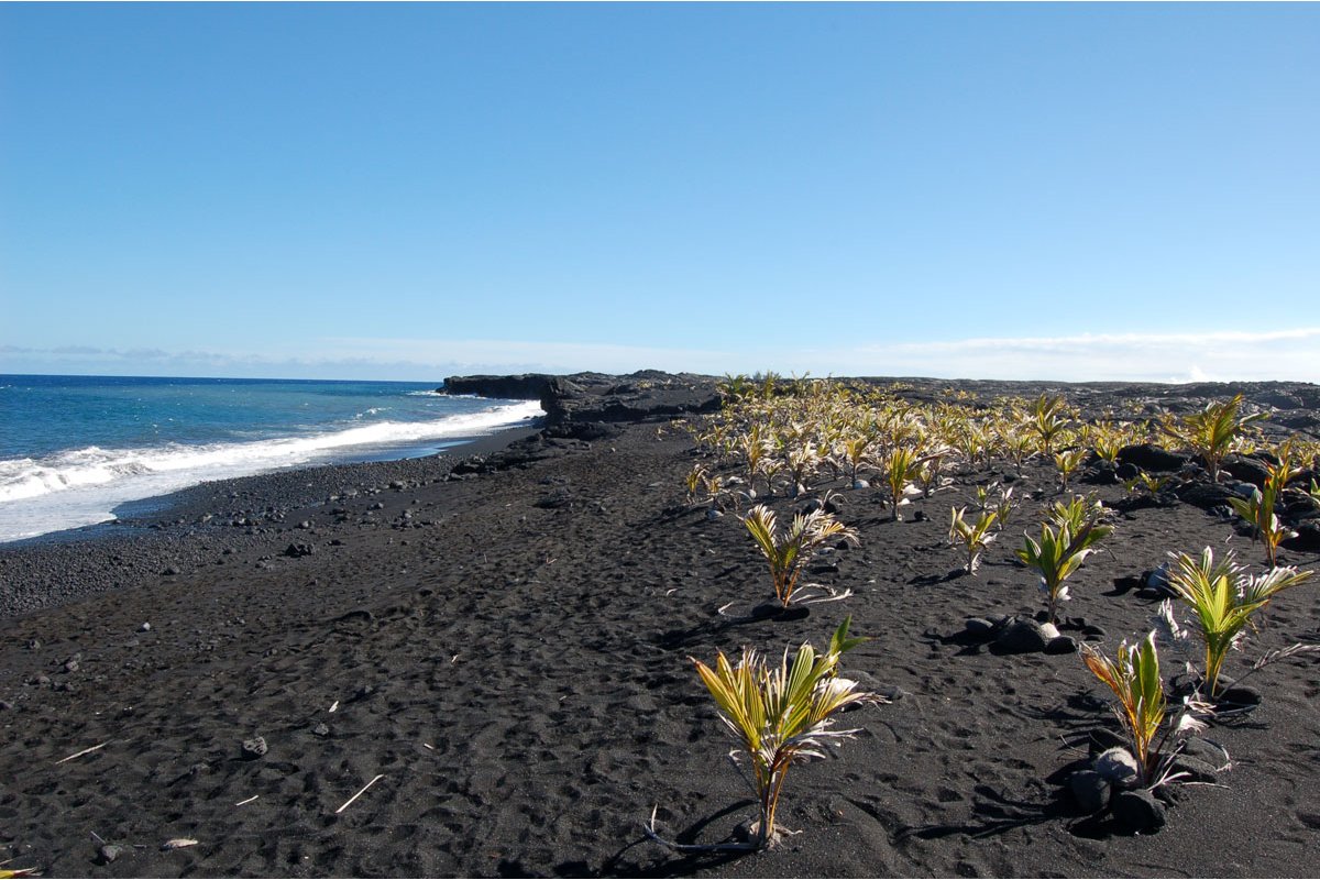
One of the premiere beach spots on this side of the island, Kaimu Black Sand Beach, was also buried during the flows. The black sand and giant palm trees made Kaimu a sought-after playground. Now, at the end of the road a path across the lava reveals a small strip of black sand forming. As the sea crashes relentlessly against the new land, it breaks down the lava which creates the rough black sand. Now, the former residents of this area are reclaiming this small beach by planting hundreds of coconut trees. Most of them are only a few feet tall, but it is a vivid reminder of the resolve of the people to rebuild the life they knew, even though this land is likely destined to face the flows of Kilauea many more times in the future. Swimming at Kaimu is extremely dangerous. It is reward enough to look behind at the rolling hills of lava and imagine what this area used to look like and the awesome force of nature that it took to bury it forever. Chain of Craters Road used to run along this coastline until Madame Pele took up a paving project of her own and wiped it out. Now the only portion of the road you will see will be from within Hawaii Volcanoes National Park. After your trip out to the beach there are a few roadside stands at the end of the road. Verna's offers a variety of flavors of ice cream and other treats. Take Highway 137 around the eastern tip of Hawaii to the very end OR take Highway 130 south from Hilo to Highway 137 and continue to the end. A "ranger" station and parking area is located at the end of the road.


